Email me at midwesternmeso (AT) hotmail [DOT] com

Please note: All images and videos on this blog are copyrighted by myself and may not be used without written permission. Any persons or entities who do not seek written permission will be held liable for copyright infringement(s) and will be subject to monetary compensation not to exceed $150,000 USD. (In pursuant to 17 USC Section 504(b) and (c), 17 USC Section 505.)

Wednesday, December 31, 2008

December 26th Storm Chase, Top Photos of 2008

Darin and I took advantage of a rare, late December storm chase this past Friday. We waited until about 9:30 p.m. before storms began to fire in response to an occluding surface low pressure, strong height falls and cool air aloft being brought in from a trof quickly ejecting out of California. The cap held strong until these cooler temps aloft arrived and a tornado watch was issued for most of Eastern Kansas and NW Missouri. Sufficient 0-3 km CAPE was present for tornadic supercells (according to SPC’s mesoanalysis), but the timing of the upper level low arrived too late for the better low-level shear to stay in place…resulting in fast-moving, elongated storms that quickly raced (in excess of 65 mph) over the instability axis (in the warm sector). Later on, as the cold front arrived, numerous storms quickly formed and numerous straight-line wind damage was reported in the Lawrence-Kansas City areas.

Below is a picture of a lucky lightning strike I shot within the few minutes we could actually attempt to document these fast moving storms at night. As a photographer, it was a tough decision compromising noise to capture the structure of the storms, or time (for exposures) to capture a lightning strike. I alternated every so often and was lucky to capture one of the very few there were.

December 26th Convection

And since it is New Year's Eve, that means time to post my top photos of 2008 that I've taken. Happy New Year's everyone, and here's to a great 2009! I may edit this post with more as I'm currently on my dialup connection via my phone!

Ziwataneo

Pillar Fog

Fogbow

halo6web

Kasatochi Sunset + Sunflowers

Weston Sunrise II

GBH

LE 2008

Wedding Day

Flint Hills Church

Radiation fog + moon + partial moon halo

Lake Perry, Kansas Fireworks

golfgoose1web

raerae05web

bikerweb

My dream girl!: (Besides my girlfriend of course ;) )
natasha2web

Project Greensburg, Greg Stumpf presenting the check to Greensburg Greentown.
stumpfgreentownweb

Thursday, December 18, 2008

Tuesday's Snow Pictures

I lucked out and saw some turkeys feeding during my 1.5 hour venture back to Olathe from Lawrence. There is a very nice 4 lane highway that I very rarely ever take, I enjoy taking the back roads and seeing stuff I haven't before. The light snow transitioned over to freezing rain before quitting about an hour later.

A few pictures:


Turkeys + Snow

Tuesday, December 16, 2008

Arctic Blast, Snow, and Freezing Rain Expected for KC area

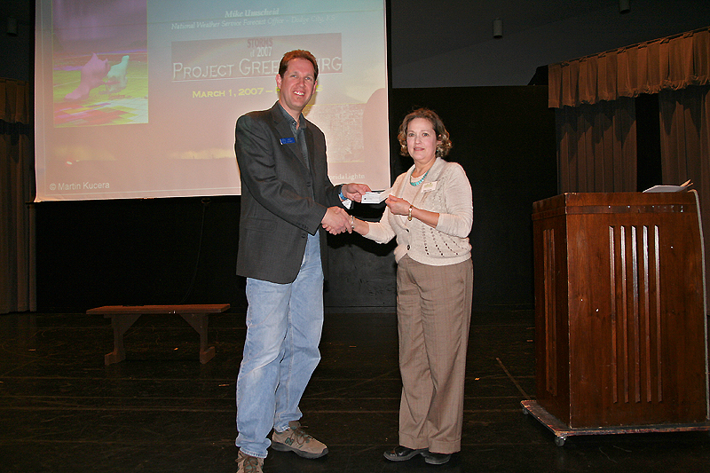
To whoever purchased a print of mine here, anonymously, THANK YOU. I have no idea of tracking who it was, sine Imagekind takes care of all of that. That was officially my first online photo sale and I thank you VERY much. I hope it comes out perfect (and should), since I uploaded the full resolution TIFF. I was talking to Reed Timmer last night, and he and Don Giuliano have very graciously offered to sell my photography through TVN as soon as I set things up. As soon as this happens, I'll post the link. I'll be doing this during the winter break as well as finishing up the DVD.

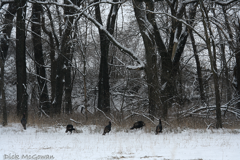
It's been awhile since I've updated this thing as I've been super busy with school and am working on my last final as we speak. On Sunday morning, here in Lawrence/Olathe, Kansas we went from a mild 57 degrees to a freezing 6 degrees and later that night, we got a dusting of snow. This morning when I woke up, there was about 2 inches on the ground and as I write this at 11:46 a.m. CDT, there is still a light, gentle snow falling despite any returns on radar. The main band that gave us the small accumulation, rapidly moved northeast and is slowly dissipating along the IA/MO borders.

I was checking surface observations and noticed this "treat" of arctic air, has pushed hard into South Texas and it's currently 39/38 in Brownsville, (the absolute southern tip, in which I was born) Texas which is reporting haze.


Photobucket - Video and Image Hosting


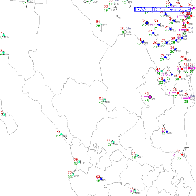
This can't be good for their citrus crop. I remember having a banana tree in my backyard and the thing died when we hit mid 40's back in the late 80's. I think it was back on Christmas day in 2005, that South Padre Island and the Rio Grande Valley woke up to snow that morning! My grandfather was up here for Thanksgiving and was complaining about mid 50's, I wonder how "freezing" he is now!

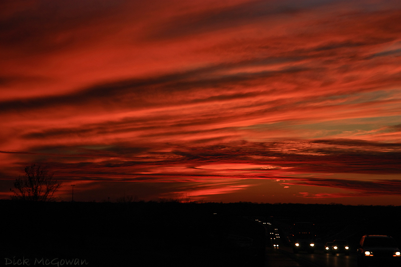
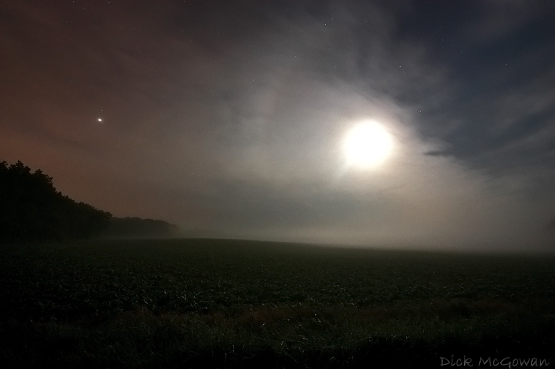
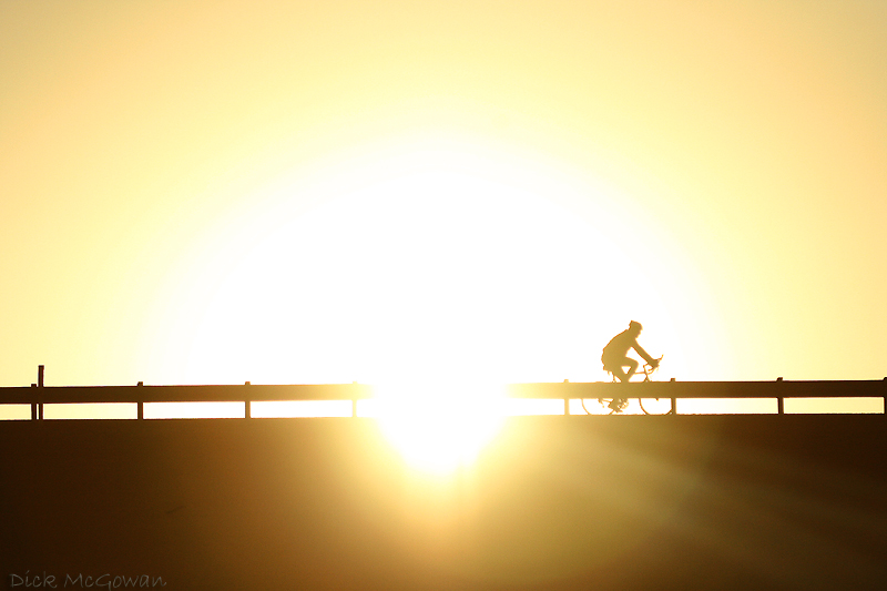
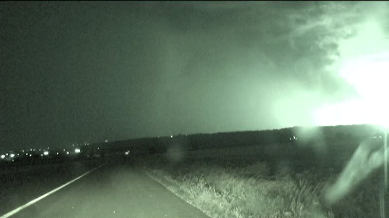
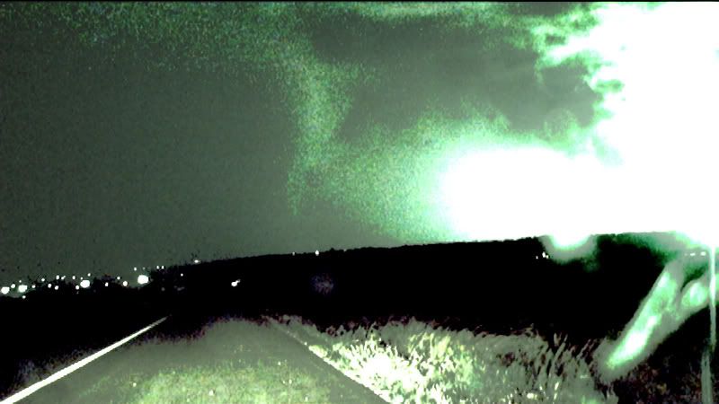
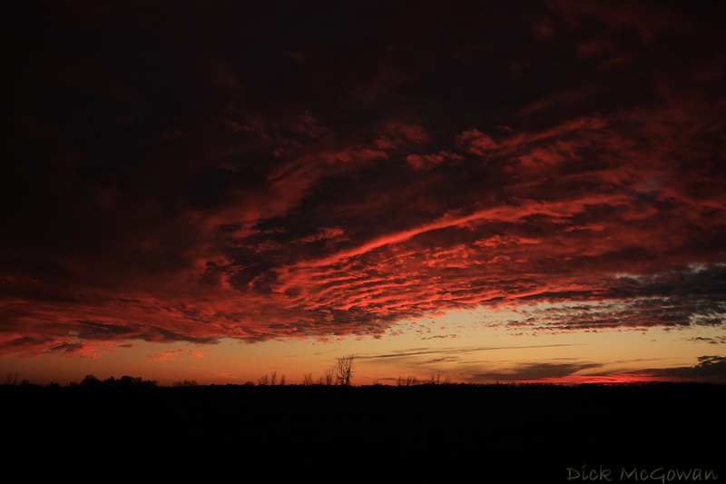
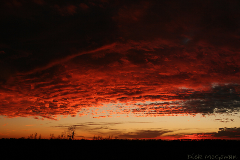
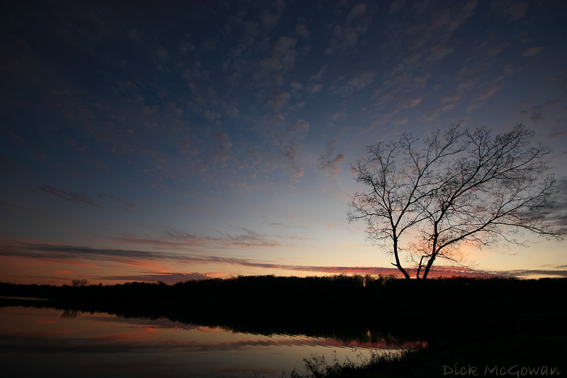
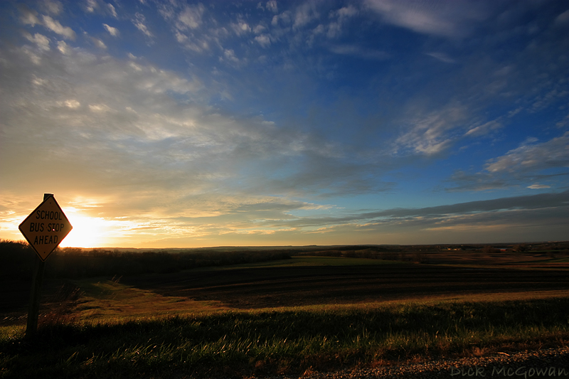
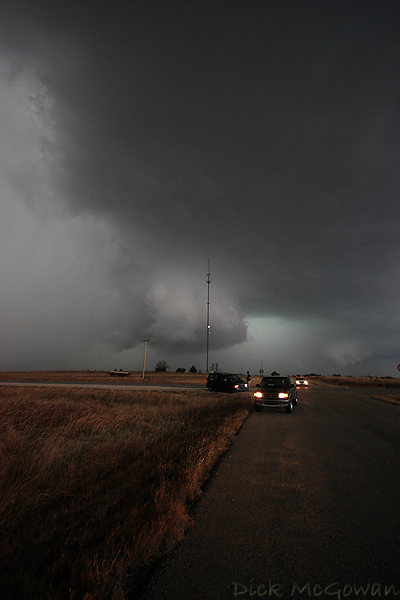
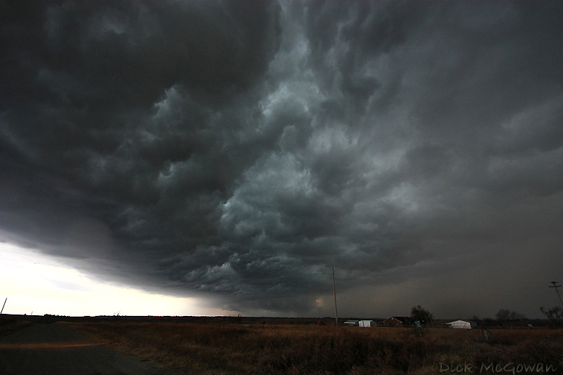
On Thursday, EAX suggests freezing rain, sleet and possibly more snow all depending on where the freezing line sets up. I'm headed out to take some snow pictures as I haven't taken jack in the past month really. I haven't had much time. I'll upload and post those here either tonight or tomorrow. Here's a picture I snapped last Wednesday on I-70...I had to pull over, it was truly amazing.


Tuesday, December 02, 2008

New Kitten Pictures

I've never been a fan of cats (I'm more of a dog guy) but when Devin adopted a 5 month old kitten back in August...Humphrey was different. I adore that cat...so we decided to get him a sister. Meet Brooks!


Photobucket - Video and Image Hosting


Photobucket - Video and Image Hosting


Photobucket - Video and Image Hosting


Photobucket - Video and Image Hosting


Photobucket - Video and Image Hosting


Tuesday, November 25, 2008

Manhattan Kansas Tornado...Beginning? New Photos

I was editing video awhile back and always check each lightning flash (since I have more time in the "offseason"), where I noticed what I thought was a truncated cone/elephant trunk-looking funnel. Below are two photos, the first as-is, and the second with added contrast.


Photobucket - Video and Image Hosting


Photobucket - Video and Image Hosting


This was shot on the southwest side of Junction city looking north near the town of Ogden. I'm unsure of the actual time, but minutes later spotters would report a tornado on the ground near Ogden. Here is a google map I created showing our location. The "Chapman" tornado (which destroyed much of the town like Greensburg, but was rated an EF-3) had dissipated to the west and the supercell was now cycling, luckily, for Junction City...and a new one would form, like I stated above, near Ogden.

We could never see this in "real" time as lightning was mostly in the core or out ahead of the storm near the RFD gust front...nothing near the updraft of the storm. This was not a chaser-friendly storm, as it was 1. Night time 2. Very HP (high-precipitation) and 3. moving E/NE at 50 mph...before slowing down to about 35 mph near Manhattan. The only problem I see with this, is that the funnel is so high-based and seems out of place...but looks rather convincing (to me) regardless...because of the laminar shape it has.

Below are some new photos, some from today, the sunset is from about a week and a half ago...this fire resembled a supercell (or did to me :) ). It was a controlled burn near Desoto/Clearview City, Kansas...where the old Army ammunition plant was. So it was nearly impossible to get very close to it, without trespassing.


112408_02web

Supercell Fire!


Happy Thanksgiving everyone!

Thursday, November 13, 2008

New Boring Pictures, New Blog

Andy Fischer now has a new forecasting blog, which you can view here. He wrote a paper, entitled, "Significant Nighttime Tornadoes in 2008 Associated with Relatively Stable Low-level Conditions" that was co-authored with Jon Davies, is available here and is a very good read!!

Below are some recent, boring pictures...I really, really need some spaceweather action or some atmospheric optics. Darin told me there was a HUGE moon halo last night, and I wish I had been up for it. I'm falling behind on the DVD production, thanks to numerous school-related projects and won't be releasing it for another month...

Sailor's Delight

Sailor's Delight II


Thursday, November 06, 2008

HP Supercell Stormchase in November

The only cool part of the day (after leaving this storm temporarily) was punching back through the core....where we met the rotation and strong inflow, and a sudden wind-shift from the north after...forcing me to slam on our brakes after a small spinup no more than 10 yards wide spun up just 20 yards in front of us. It scared the crap out of me/us. Darin then told me to floor it after the wind-shifted back to the east as the rain bands slowly rotating around us (I watch the road not sky and focus on driving in tense situations such as this). That was about as cool as it got.

We had problems streaming on TornadoVideos.Net yesterday...not for actually streaming, but my computer locking up after about 3-5 minutes of doing so. We currently use AdobeFlash Encoder 2.5 and I think we might have figured the problem out afterwards...definitely need to tune things up better before 2009.

Here are some pictures shortly after that:

HP Supercell

HP Supercell

HP Supercell

Whale's mouth

See ya 2008!

Saturday, November 01, 2008

Halloween Harvest

Thanks to Mike Hollingshead for the great ideas. I was heading to Devin's last night and stopped for about 15 minutes to shoot some photos of a farmer cuttin' beans on Halloween at dusk. My tripod is a POS and I'm taking it back because it broke...I should just get a good one

Combine

Cuttin beans

I don't wanna leave you on the farm

Thursday, October 30, 2008

Storm Chasing DVD is Nearly Complete

Since I have music on here and is unable to mute (to shrink the player), I'll just post the link to the final trailer, which is here. The yelling at the end was after nearly a full year (to the day!) of me seeing a "real" tornado and was left on there in honor of the yahoo chaser. I'm hoping to start burning a lot of these by Sunday and they will be for sale on our newly designed TornadoLive.Com and also TornadoStore.Net

I was driving to school yesterday and there are always homeless people on the ramp where US 169 and I-35 split...on the off ramp. I am always reluctant to take their pictures when they are looking right at me, so I did when I drove by. The autofocus didn't work so well, but I like the way this one turned out. I'm thinking of going downtown again today and snapping some pictures of the poverty that plagues this area...as I have not taken very many pictures in the past few weeks and am lacking any creativity lately.

Forgotten

Thursday, October 23, 2008

Obama in Kansas City

At the absolute last minute on Saturday, (instead of going to Jon Davies party, which I'm sorry I didn't make) I decided to try and snap some pictures of Obama or at least try to when he was speaking to over 75,000 people at Liberty Memorial Park in downtown Kansas City. I showed up around 5:50 when he was due to speak around 6 p.m. I thought I was pulling up to the front, but was on the wrong side and had to walk up an exhausting mountain only to walk another 1/4 mile to the crowd!

Obama in Kansas City

I tried to use my height and body size to push through the crowd, but for the first time ever, I felt claustrophobic...and left shortly after Obama made his way to the podium and spoke.

Here's a view of all of the vehicles on the west side of Liberty Memorial and the beginning of a brilliant, calm sunset.

Obama in Kansas City

Happy Halloween everyone!

Jack-O-Lantern

I'm running out of time but plan on posting a couple of more pictures from this past Saturday...

Contact Me

Contact me @
midwesternmeso AT hotmail (DOT) COM

wibiya widget