Email me at midwesternmeso (AT) hotmail [DOT] com

Please note: All images and videos on this blog are copyrighted by myself and may not be used without written permission. Any persons or entities who do not seek written permission will be held liable for copyright infringement(s) and will be subject to monetary compensation not to exceed $150,000 USD. (In pursuant to 17 USC Section 504(b) and (c), 17 USC Section 505.)

Wednesday, November 30, 2005

November 27th's Tornadoes


Just pictures and a detailed map (Map Credit Darin Brunin www.shadowoftheanvil.com ). (From the best that we could recall) We had a little KS map, no radar,no GPS,no hams, just a cellphone and EXCELLENT nowcasters. After they got us to the storm, service was out and we went visual.

Monday, November 28, 2005

Yesterday's Summary.


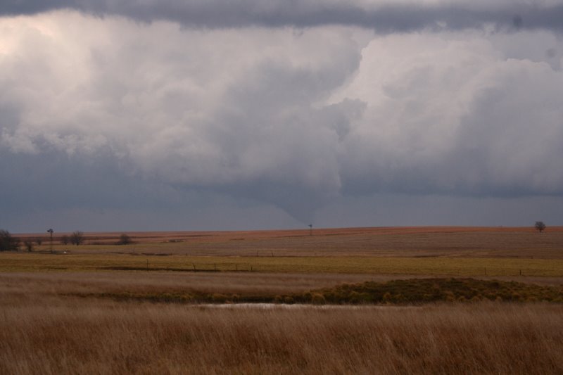
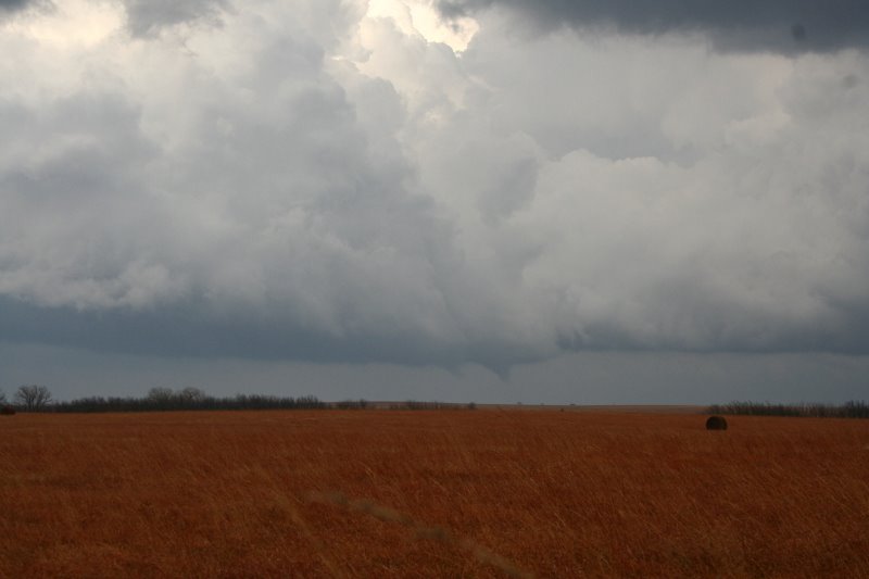
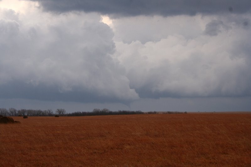
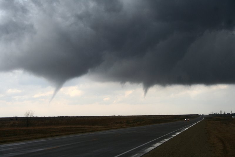
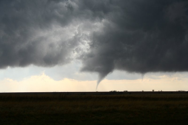
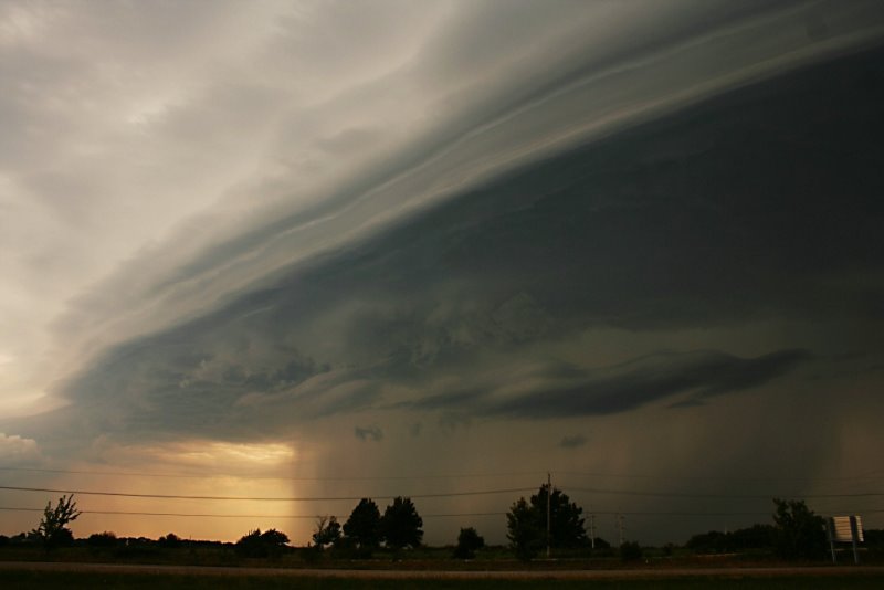
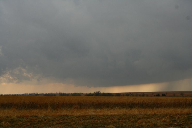
I'll sum it up short. We analyzed SPC's mesoanalysis page at around 11 a.m. A decision was made for Topeka, KS. About an hour later we received a call from Nick Grillo giving his thoughts and sharing with us his observations. Thanks for that Nick. Darin then called Roger Schwartz of WIBW in Topeka, KS, and thought Emporia might be a better idea. So off we went. Soon after we received a call from Eric B' Hymer that an Mesoscale Discussion was up and a tornado watch would be issued soon. Minutes later it was for much of Eastern KS. At about the time we were about 20 miles from Emporia on the turnpike, Darin called Stewart Manning for an update. There was an impressive cell near the Butler Sedgwick County line, and we calculated the time to intercept and felt this was the cell we wanted to be on. We went west on highway 50 then turned onto 150 highway where a base was visible. We drove a little further north to stay on southern edge of this new mesocyclone. Here are some pictures from beginning to end starting bottom to the top: First Picture base, and at this point we turn around seeing a new storm starting to seed ours. So we drive back south but just for about 2 minutes. I look back and say "Oh man it's getting it's act together." A small funnel emerges, we reposition back, and I began to shoot these first photos. Timeframe from meso to funnel cloud, I would say 3 minutes tops, and notice how fast the RFD cuts in and the meso wraps around.

I will post the other tornadoes later, gotta run for now.

Sunday, November 27, 2005

Long story short saw 3 tornadoes. Will post more photos than were on stormtrack tomorrow. Very exhausted but very pleased. Thank you Jesus, I love Jesus.

Friday, November 25, 2005

Slight Risk for Olathe

After glancing at the ETA and GFS last night an initial target of Emporia was made for Sunday. Each run deepens the low, slowing it down and I think enough instability can make this a Cold core type set up. ;) 50 knots of vertical shear should do the trick, so I am hopeful for a chase at the moment.

Just got done watching a scary Texas vs. Texas A&M game, which Texas pulled off at College Station 40-29. Vince Young played like crap, it's good we have other talent on the field for his lack of, today.

Fall Picture:

Thursday, November 24, 2005

More Severe WX?

It has been brought to my attention that we may have yet another round of severe wx breaking out across parts of the U.S. Looks like I might get one more in for 2005, but I am not getting my hopes up. If nothing else, I expect maybe some sleet/snow by sunday night into Monday morning per GFS/UKMET. I am ready for 2006, 2005 was hard to come by for tornadoes, hit and miss days.

I had been wanting to take this photo for months and finally took the time to do it. Enjoy.

Wednesday, November 23, 2005

Contact Me

Contact me @
midwesternmeso AT hotmail (DOT) COM

wibiya widget