Of Oklahoma/Kansas. Will be meeting up with Darin Brunin and Mike Shively soon and will decide on a target in a bit. Enid looks good. Hope storms don't get undercut by stupid cold front. Either way, should be interesting. This will be the second time this month I venture to Oklahoma. Good luck to everyone out there, be safe.
Will try and update this thing on the road.
Monday, April 24, 2006
Sunday, April 23, 2006
Decided against chasing today
Shit for shear, questionable dewpoints, and a "surface trough" way the hell out in my old stomping grounds.(Which Neal Rasmussen corrected me) It's not a dryline.
SPC just downgraded to 2 percent, but that's not stopping Shane Adams from chasing. Shane pulled a marathon chase the other day, that was pretty hardcore!
Plus, your "weekend warriors" from TX, OK, CO , will be all painted up with warpaint, craving maybe their first tornadic storm of the year (and lack of in the state of). I've been lucky, it's been all relatively close for me. KC is such a good location.
Looking at tomorrow for a possible chase. You've just gotta go for these SE KS chases, (last I looked) it's a magnet. Good luck to everyone, it's almost freaking May.
Thursday, April 20, 2006
Couple of Pics
Don't have much to say other than I have enjoyed my last couple of chases and I'm sure most of you have read the reports so I'll toss up a couple of pics. Last chase near Chilicothe MO, was indeed fun, storm moving so slow, we played in the hail, and watched rotation over our heads. Treated to an "Ice Cream scoop sky." ;-) at sunset. Photos are as is, too lazy to photoshop and I accidentally shot the ice cream sky in jpeg whoops.
Monday, April 10, 2006
4/6/06's Account
 Tornado #2 immediately to our west

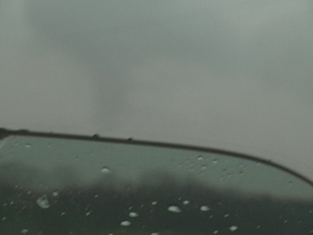
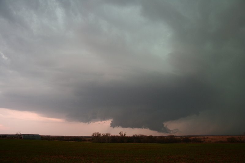
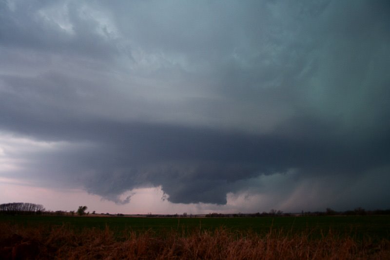
Darin Brunin, Eric B' Hymer and Jordan Wrecke departed Lawrence around noon and headed west to Topeka. There we checked data and proceeded to go to Junction City, where we again checked data. It was decided that the storm in Reno county, could be the player of the day, so we darted after it. Intercepting it south of Salina, KS, the storm looked crap visually, so we decided for our secondary target, SE KS. Well, I'm glad we didn't. We all noted, the strong shift in backing surface winds (which were strong Southwest before), and turned around on I-135 in McPherson County. Long story short, we followed it to Salina, where it started to show some weak rotation. On I-70, the interstate was covered in hail, semi's flipped, making it difficult to catch up with the storm. Construction was coming up, so we pulled off on a county road (that was headed to Manchester KS) and booked it straight north. We found ourselves in the bear's cage quick, and I was PRETTY nervous. Rotation was observed everywhere above us, north, south, east, west. Lonely on this county road, we kept heading north, when out of the precip curtain to our northeast no more than 1.5 miles, I yell "Stovepipe!" A beautiful stovepipe emerged. Almost immediately to our west, a new wall cloud was rotating, and put out a smaller tornado which was short-lived, but CLOSER. We booked it east as the tornado was roping out on County Road 422 heading towards K-15. We then raced north to stay ahead of the storm which was approaching Clay Center. Darin did a live call-in to WIBW about the storm, and as we reached Clay Center, noticeable RFD pflumes were about 100 yards to our west. The storm had developed a huge meso. Hard to see anything at this point, as it was buried in precip. We headed east on 24 to get the hell out of Clay Center, thinking it was going to get hit, and noticing strong winds in the city itself. We jotted north on a highway I can't remember now. Decided against chasing this one and headed for a new torn-warned storms near junction city, watching about 5-6 chasers fly north to catch this thing. Wish we would have stuck with it as Mike Hollingshead and others grabbed another very nice tube near KS/NE border.
A few video captures, had no time for stills...
Wednesday, April 05, 2006
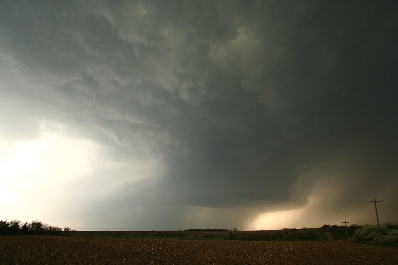
A Second Look at Buffalo KS torns
As we heard the report of a tornado over the wx radio near La Harpe touchdown, we assumed it was bullshit since we were just south of that location. Mike Hollingshead emailed Darin and I and showed us what we now believe is a second tornado just to our north buried in precip. It resembles a carrot and debris appears to be under the fully condensed funnel as we passed east of Iola. Hopefully Mike will add it back up on the his page at some point. And now to Thursday..........let the fun begin!
I've decided to apologize to Steve Miller for our recent, pointless arguing, as he made a good point that the storm chaser community is dividing, and the blog wars really get us nowhere. We all share that passion, and not once have I met a storm chaser I haven't liked, and I'm sure Steve would be no exception.
Thursday's setup has a shot at being a high risk. I posted my (what i call) "shit" forecast here . Still a couple days out, and my mind will change all the way up until we leave or are leaving. Either way a significant event is unfolding, and I do not feel like chasing storms moving fast into MO, it's a deathwish. I pray that no loss of life or property comes with this system, and wish good luck to everyone chasing out there on Thursday. Report everything! As storms will be moving fast, and 1 extra minute of warning could be the difference between life and death.
Dick
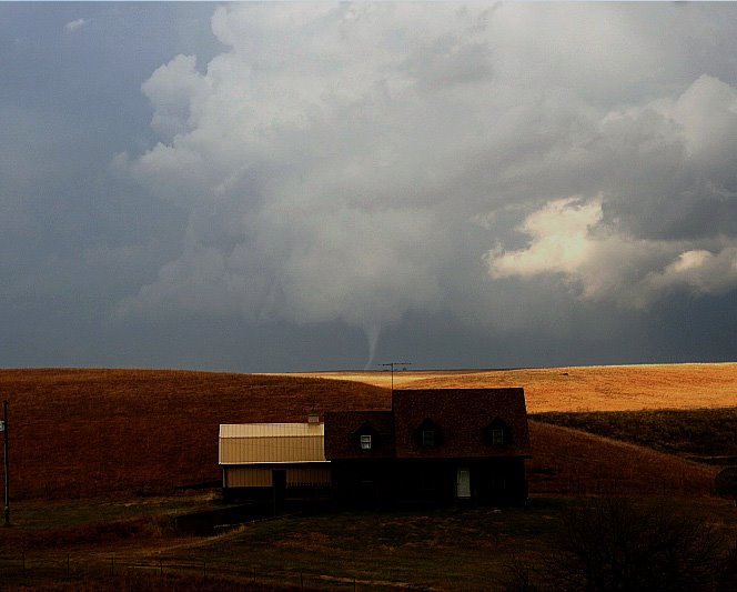
Pictured above is one of the cold-core tornadoes we grabbed on 11/27/05. I just redid it to enhance the structure and tube more. Very proud of this image with the house in the background. Not as good as Eric Nguyen's mulvane/house shot, but for an amateur like me, I'll take it.
Tuesday, April 04, 2006
From TX to Illannoyed

In two days of chasing. 00000 tornadoes. Here are some pics of Saturday near Elk City OK. Sunday I chased also, nothing like elevated, outflow dominant pieces of crap, that turn tornado warned after you ditch them, and lay down some nice tubes after that. Oh well, we're just getting started, and Thursday looks like another floor it, pilot-license only chase. So used to these fast moving storms, was shocked on saturday, when we actually could ENJOY the storm!
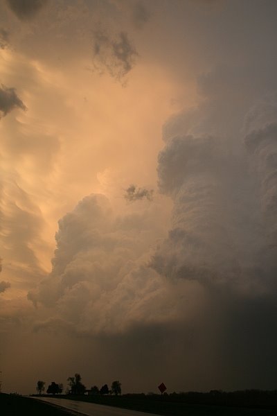
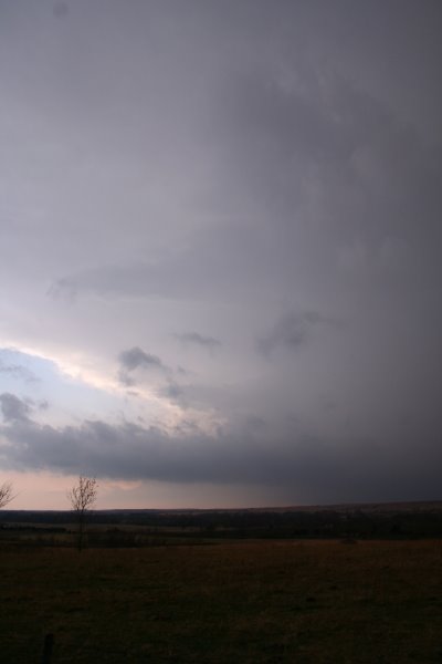
First image is of Buffalo KS storm structure where we shortly after scored a black snake tube (Still grabbing a pic off of video SD card is acting up). This is the hill where Mike Hollingshead showed up out of nowhere, and within 10 mins was gone again. Roger Edwards, Rich Thompson have some great photos of the Buffalo tornado, while we decided to play in the hail and catch the ass end of the tube.
:)
Subscribe to:
Posts (Atom)