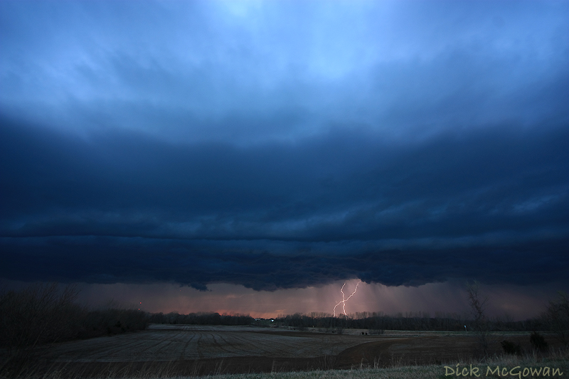
Marginal instability, unidirectional shear and an quickly-advancing cold front can only guarantee you one thing...shelf clouds...extremely high-based shelf clouds. Nevertheless, I had the day off, drove almost to Emporia, KS and saw some decent storm structure. The lighting, at sunset, was just enough for one to shoot a 3-5 second exposure and have enough sun peeking through the base to capture the structure and then have a chance at getting a lightning strike. My one and only lucky strike I shot was the only keeper of the night. I headed home as the storms weakened as they headed into more stable air (39 dewpoint here in Olathe). Brandon Ivey, further south, captured a gustnado in Cowley County. His video is here.
I'm still tornado-less in 2009, but am hoping for a chance to eliminate that on Saturday in Western Kansas.
In other chaser news, a "storm" chaser has been caught red-handed of manipulating a photo to show a tornado that wasn't there in a recent report on Stormtrack. It's out there if you look hard enough. Some advice to the guilty: If you're going to manipulate a photo to show that a tornado was in it, make sure there weren't 200 other storm chasers on it who were much closer and didn't see what you claimed to have.
1 comment:
Nice shot dude! yea I got about 3 lightning pics of the shelf here in Olathe, and there was maybe five lightning strikes in 20 minutes. haha.
Post a Comment