Email me at midwesternmeso (AT) hotmail [DOT] com

Please note: All images and videos on this blog are copyrighted by myself and may not be used without written permission. Any persons or entities who do not seek written permission will be held liable for copyright infringement(s) and will be subject to monetary compensation not to exceed $150,000 USD. (In pursuant to 17 USC Section 504(b) and (c), 17 USC Section 505.)

Monday, June 30, 2008

Lightning Photos in Downtown KC, Surprise Structure/Funnel


Above, are a couple of more pictures from last weekend on Clinton Lake.

Derek and I headed out on Friday night to downtown KC when we saw a developing MCS moving its way and ended up following it till dawn which yielded some amazing structure and a high-based funnel on an updraft occlusion at ~ 6:30 a.m! It was one of those storms where there was constant lightning, and not a second went by you couldn't see CC's or CG's...but, it was very difficult to photograph them unless you got into the rain. Derek uses my old XT with the Sigma 10-20 and I've been showing him how to use it and he really enjoys getting lightning shots. Some pictures are below...


Derek shot this one below of the Sprint Center in downtown Kansas city on top of the parking garage across from the new huge McFadden's bar in the new power and light district...which is a very hoppin' place the three nights we've been by there.


The structure of this supercell below (yes, it was supercell, with a persistent mesocyclone) was incredible and surprising. It formed very near Fort Scott, Kansas from to the northwest from the outflow of the southward pushing MCS at around 4:30 a.m.


It had a huge vault and as we moved east of Pittsburgh Kansas with it, would develop a clear slot and eventually it's occluding updraft would produce a small rope funnel. Too bad it wasn't surface based or I'm sure it would have produced.

Pictures of some lightning shots (below) at dawn looking into its core...probably my best one of the year at 17 mm (very close):


Here's the back side of the updraft, there wasn't any rotation visible...


About 10 minutes later if that:


Close up


Wide angle (notice the occlusion and the new updraft forming to the right)


Gave up on it after that, as energy drinks weren't keeping us up any longer and we watched it strengthen, showing some good rotation on radar...but it was never severe nor tornado-warned.

The night before, Darin, his girlfriend Lexi, my girlfriend Devin and I sat out at Clinton Lake on the dam and watched an LP storm, that displayed supercell characteristics, for a couple of hours. Of course I didn't bring my camera and Darin's battery was only good for a few shots before his battery died. Incredible lightning, with no rain at all. Very symmetrical CG's, with the leaders branching out into a perfect "family tree" that would do a complete 360 around the sky before ending it perfectly with a powerful CG. It did this at least ten times and freaked out others watching on the dam to take off and leave! I've never seen such a display, with lightning strikes that would have made for perfect photographs. Oh well.

I have tons of more pictures to upload as well as video to edit.

Monday, June 23, 2008

Storm Chaser Wedding, More Video Captures of the Manhattan Kansas Tornado, Tons of Pics

I have been sick the past day, vomiting from either food poisoning or some kind of flu shit, but wanted to get these photos up...Here's what I said on the thread on Stormtrack concerning Jon and Shawna's wedding:

After informing Darin Brunin and I back in late March of their engagement and "wedding plans," we were very honored when they invited us to a very special wedding today, which included several other chasers, including: Rick Schmidt, Doug Nelson, Jim Reed and crew, Rev. Aaron Blaser and his wife, Mike Phelps, Evan Bookbinder and several others I can not recall at this time (sorry...).

On June 19th, 2008 at exactly 5:30 p.m., Jon and Shawna Davies were married under a brilliant mammatus display just south of Manhattan, KS today, which overlooked the majestic Flint Hills. Congratulations and best wishes to them both!!!! It was a very memorable and unique wedding that every guest can attest to!


Some photos below of the wedding that Darin and I both took...


I went back and looked frame by frame on the Manhattan tornado (which the NWS in Topeka was unsure of my video/captures, which is fine with me) and I'm still confident a fat cone is what I captured. These are the full resolution photos, so I'll just post the links or else it might take years to load this blog.

Click on the links below:

First Capture
First Capture (contrast enhanced)

Second Capture
Second Capture (contrast enhanced)

Third Capture
Third Capture (contrast enhanced)

Our Manhattan, KS EF-4 tornado video can be viewed here. and more screen captures are here.
We never actually saw the tornado, but rather the power flashes.


Anyways...here are a few photos of a beautiful red glow that I snapped two nights ago at Clinton Lake. It's not fake, it's not over-saturated and my camera is always on auto white balance. I do not mess with colors at all, just levels and contrast, and of course sharpening. I shot some wider angles for "proof" , because many people, including my own girlfriend love to ask if I "photoshopped" it. That's sometimes other chaser/photographer's excuses as well. Instead of taking the time and having the patience to learn about photography or post processing, they say someone "photoshopped" it. Man, that drives me nuts! Just because you bought the top of the line camera and lenses, doesn't mean your photos will come out like Mike Hollingshead's. I'm lazy and don't know much about metering when shooting photos, so I cheat, and shoot in AV mode and compensate the exposure (almost always underexposed). One of these days I'll learn how to expose better.

Using my Canon 100-400 telephoto:


Then a few minutes later on the Sigma 10-20 IIRC...


I have more pics coming, as soon as I stop puking...

Saturday, June 21, 2008

My Flickr Photo Page

Is here...I'll continue to add more throughout the weekend, I've got a long ways to go...

I've also added some "Chaser tunes," or the ones I think are...if you don't like it, it has a mute button on it. If it gets annoying, leave a comment, and I'll remove it.

Going to add photos from the wedding of Mr. Jon "The General" and Mrs. Shawna Davies wedding soon...two great people I'm glad to have been lucky enough to meet and talk with over the last few years. I can accredit Jon for almost every one of my tornado intercept days...and Shawna is like a "chasing" mother to me. She always has great advice for whatever situation, whether it's chasing or just life in general. Congrats to them both, it couldn't have happened to a better couple.

Tuesday, June 17, 2008

6/12/08 Chase Account, Lightning Photos,

Darin and I were talking about how when you get on a storm now, you can tell right off the bat whether or not it's going to produce, and this one just didn't seem to have it. Some shitty photos I took as we are approaching a tornado-warned storm in Chase county, near Cottonwood Falls (while driving). I'm not sure why the white balance is jacked as it is, maybe through the tint...


Rotating pretty good (below) here. Darin, his girlfriend Lexy and I were alone at this point, as I pulled up at the top of this farmer's road, which was a big pasture. It was the perfect viewing area spot and we were all enjoying the scenery, then look behind us and realize there are loads of vehicles behind us, including the UMASS phased array/dual pole or whatever project they are doing now...Hi guys!
Haven't seen you guys since all day yesterday! (the day prior, we had found a nice road construction hill near Concordia and out of nowhere they and others pulled up behind us too) It's weird how you'll see the same chasers several days in a row and never see any others.


Saw Andy Fischer nearby, so I know we're on the right storm! We saw Andy around a lot in 2006, and he was bagging tubes left and right, while others never saw a tornado. I'll never let 9/21/06 go, Andy was all over the Russell cold-core tornado...meanwhile it's our first day with radar (wxworx piece of shit unit, my friend's is still sitting here in my room since that day!) ever and we blow it on the storm to its west.

Funny to think about how Darin and I never had any data chasing until 2007 (one day in 2006), weather radios, a paper map, and occasionally a quick wifi (if we could find a damn wifi spot)check on radar or SPC's mesoanalysis less than 2 years ago, now I bitch about a GR3 radar scan not updating.

Some lightning pictures I've taken over the last week, if the Canon Rebel Xsi is better than its predecessors, it's the live view shooting lightning: big LCD screen and quick manual focusing to infinity without having to lean over. Piece of cake.

I'm behind in emails, returning phone calls, etc...I'm not avoiding anyone, (if you are reading this) I have been busy and am awaiting some big (non-chasing) news I've recently learned about last night and am very excited!!!


Neal Rasmussen-style spark pics:


Saturday, June 14, 2008

Manhattan, KS Tornado and Damage Video

EDIT: If you are looking for pictures of the very rain-wrapped Manhattan, KS EF-4 tornado, I have posted some screen captures here and here

Thanks again to Reed Timmer for putting it up.


High Quality: http://www.youtube.com/watch?v=fGTqQsNlyr8

Friday, June 13, 2008

6/11/08 Chase Account, Manhattan Kansas Tornado, Salina Possible Tornado

EDIT: the full Manhattan, KS EF-4 tornado video is located here.

More video captures of the tornado are here.


Jordan and I intercepted 3 supercells, the last the most significant (which was after dark) that claimed the lives of residents in Chapman and Soldier, KS. We reported via spotter network that we could see power flashes in Salina, and then again near Manhattan, and other chasers such as Brandon Ivey and Scott Bell were as well, and helped keep residents safe.

Above are some video captures of the tornado, illuminated by power flashes, as it hit Manhattan from where I believe to be on the SW side. We are filming on Highway 177, looking NW approaching southern Manhattan.

We were trailing this supercell as it approached Manhattan, the one prior had the most incredible structure(I mean that too, even vs. May 22 07) I have ever seen in person. Too bad it was moving east at 50 mph, and we couldn't stop long enough to get good pics. I was shaking as I was taking photographs (400-800 ISO :( ) because I knew I had to get a picture of this for my wall.

Some pictures of it below, wowowowowowow.....if only I had 5 more minutes.....even 2 more. Still glad I saw it, this is why I chase right here.


The storm before it near Concordia at 10 mm...incredible structure too, reminded me of a storm Mike H was on, only not as round.


Starting to wrap up good...


Tries to do it, but it's very high-based...


What a day...but a day that ceased our enjoyment, when we found out about all of the fatalities from the tornadoes. I wish people would just pay attention, get out of their vehicles or mobile homes and seek a more safe shelter. Twice this year now, I've smelled the "smell" of a tornado, which I thought would never happen again. It's something you can distinctively remember, can't explain, and sparks memories of May 4th, 2007 all over again.

My thoughts and prayers are with the victims and their families. More in a day or two, I've got way too much shit to process, upload, etc.

Wednesday, June 11, 2008

5-22-08 Video


The ending..... As we were trying to escape, looked like a wall of rain just before. It was beating us by a scary margin that seemed unreal, as we moved east out of Wakeeney at 80 mph. We ended up being on the outer edge of an EF-1 tornado, that did some damage in Wakeeney. In the video, I say,"This is not good, then say "we're good." Not wanting to alert the others and make them panic, I said it was outflow, but you can clearly see we are driving east, and the strong inflow is moving west. What we didn't film, was the intense wind shift prior, or the "wall." Many other chasers/mets can vouch for this insanity at dusk near Wakeeney. We didn't see it in our rear view, and the idiot with the light bar truck did 20 mph and flipped his lightbar on when we were all hit. I guess that he thought it was going to save him. While they were moving slow through this situation, I passed them in the right lane and wished them good luck.

I'll never forget that sudden wind shift, which at one point, I swear...it stopped for just a split second. The, "Oh shit, this isn't going to be very fun" shifting of the winds! We talked about it with chasers we knew in Hays afterwards, and they still looked pretty shaken up about it, as we were too!

Chasing the less favorable target today, probably from CNK to HLC, if it's too crowded with chasers, then further south for something more conditional, NE of DDC. So if you are a chaser and are reading this, please go to Iowa and Nebraska! I can't ignore the beautiful UL divergence at 100 knots, with a southerly llj at around 40 knots at 0z.

Monday, June 09, 2008

Storm Chase Account from 6/3

It's been awhile and I'm very lazy when it comes to writing. Tuesday, June 3rd, Derek Shaffer and I watched a storm develop and move very slow to the east taking pictures of the towering cumulus clouds and jumped on it right before it briefly went tornado-warned NE of KC. Some views from the back side, took us about 4 minutes to catch up and we tried to get east of it, but didn't make it in time, when the wet RFD
came crashing down. Most of these shots are at 10-17 mm, so in reality, are approximately 5x closer than they appear.

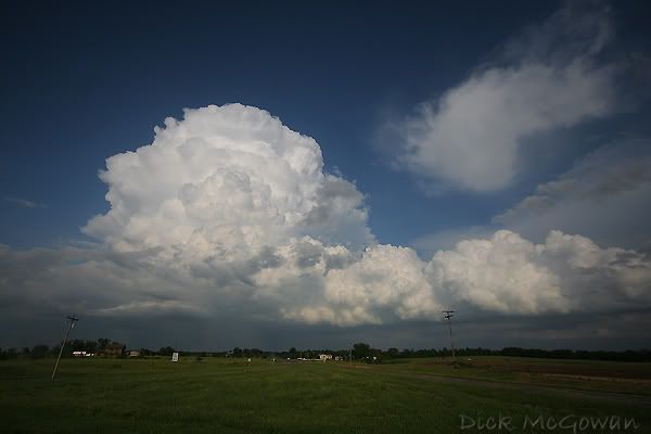
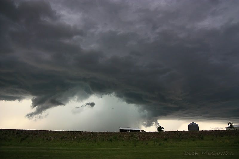
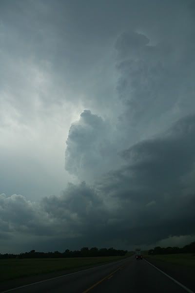
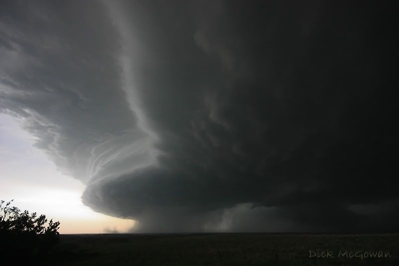
About 30 minutes after initiation, a more promising updraft is towering with a flanking line, looking east:


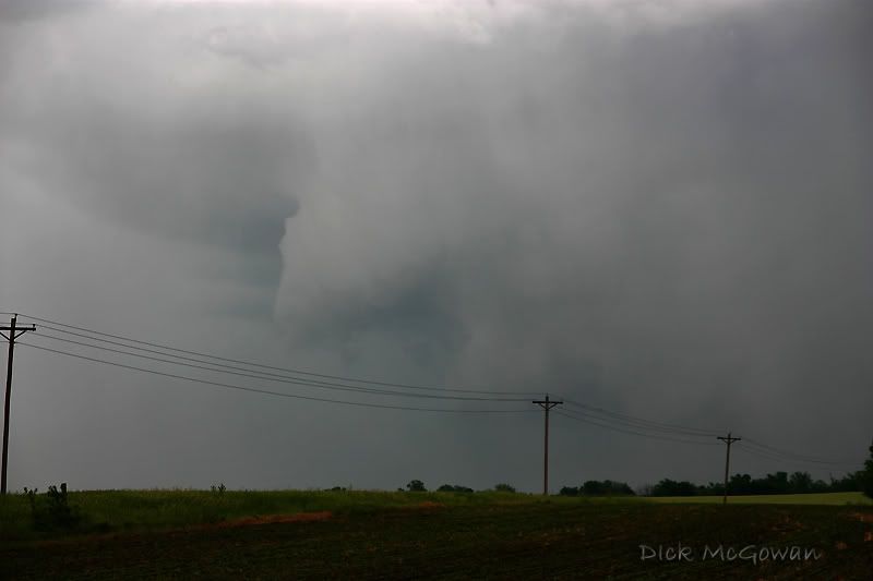
Right as it was tornado-warned, interesting feature/lowering looking to the east/northeast:


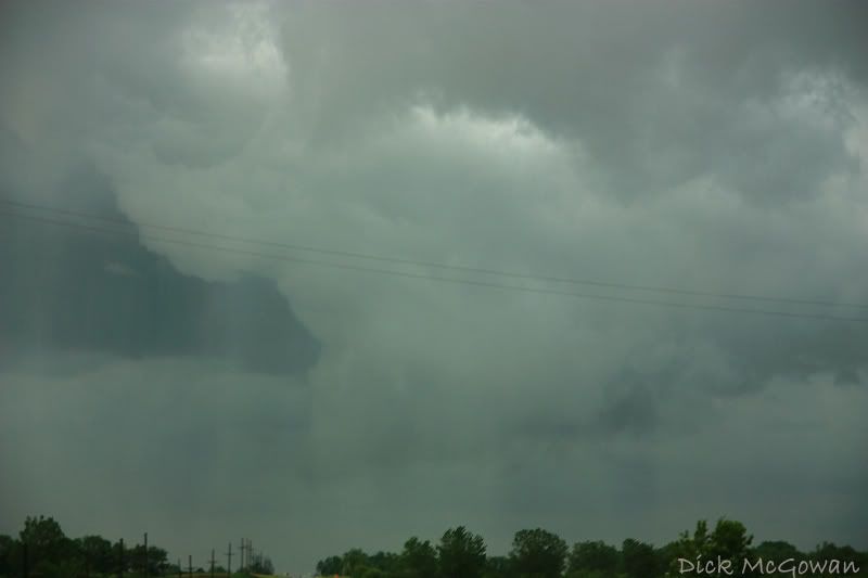
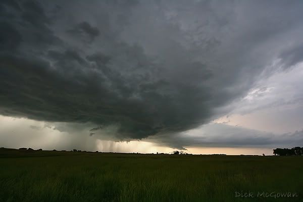
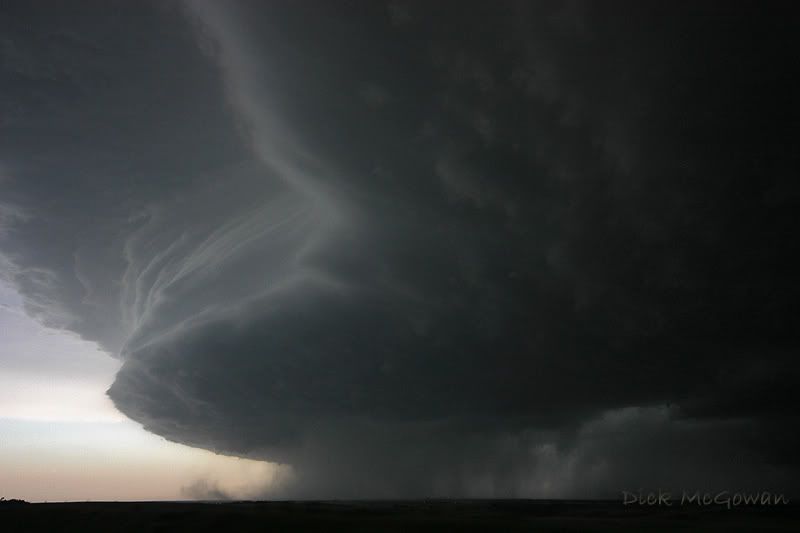
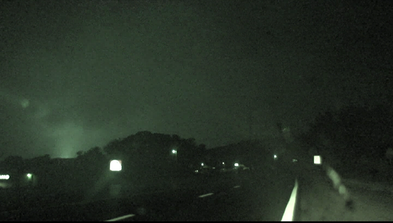
Contrast is still low as we continue east with the precip in the way, but what appears to be a clear slot developing on a wall cloud that had weak rotation:

Added a lot of contrast and it gives it a green color, it wasn't as clear as this when we saw it:


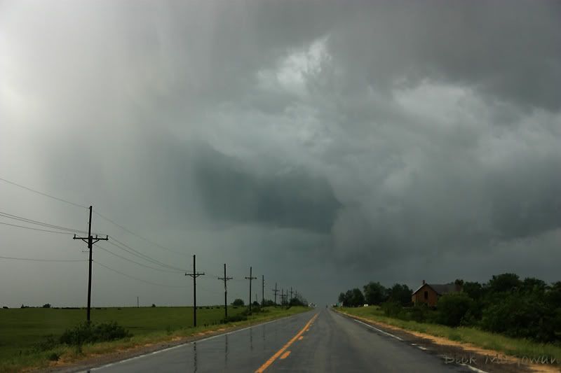
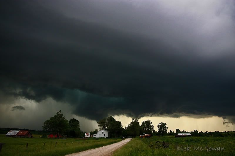
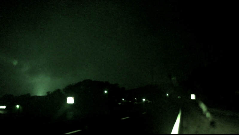
A little further east we went towards it and the contrast is getting better:


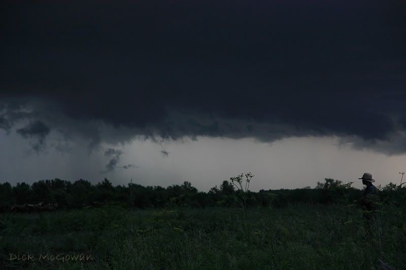
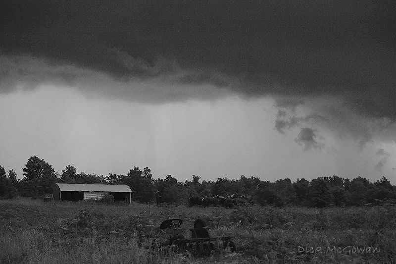
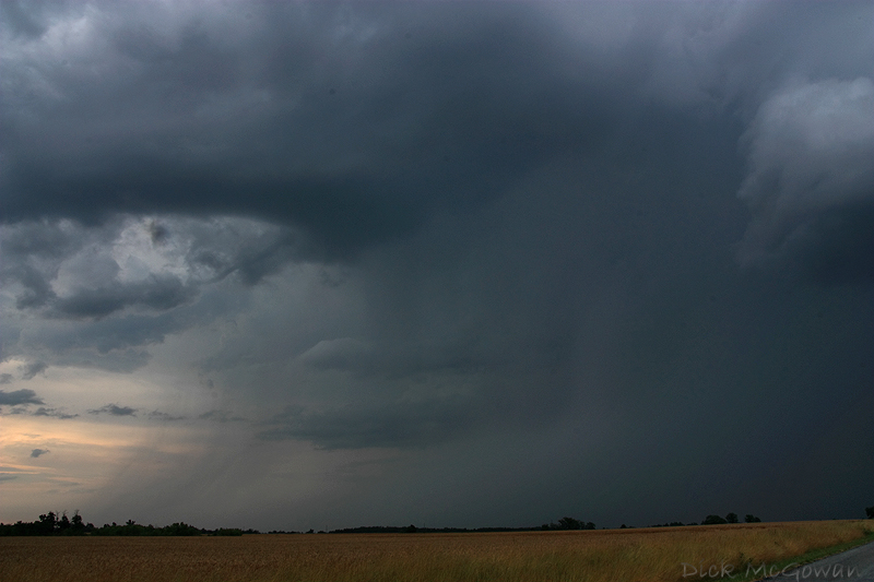
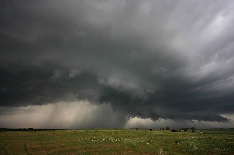
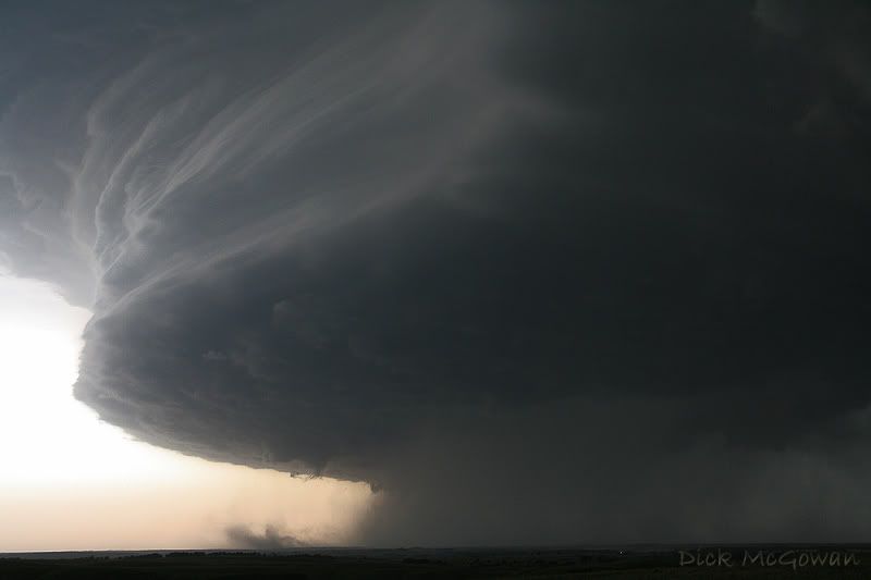
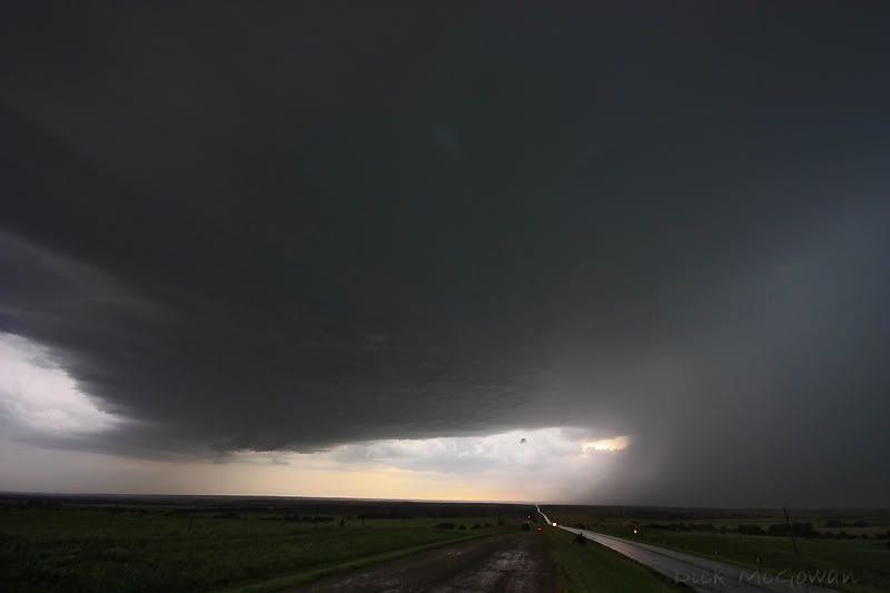
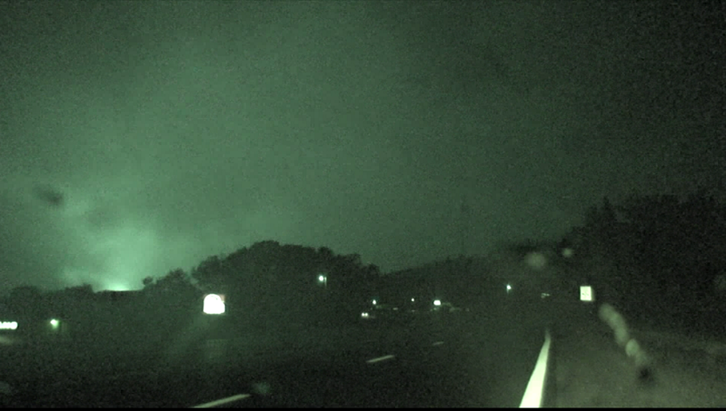
We then get almost around it, as it's now just to our east, and a wet RFD just blasts us, as the wall cloud is now rotating pretty decent, before precip wraps around forcing us to drop south a mile.

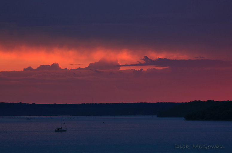
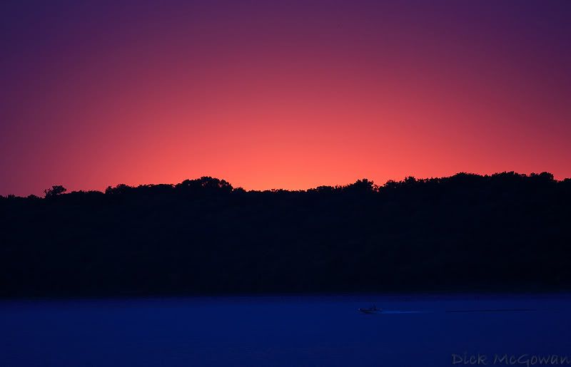
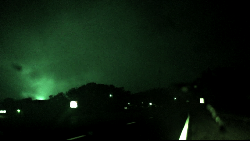
Last look at it, as cold outflow is killing it and it's gone in the next 10 minutes. The crack at the top is from a nice baseball that came out of nowhere on May 23rd after the Quinter tornado while trying to turn around on I-70. No hail before or 2 minutes after this...the one and only stone within miles, hits my windshield aimed right at my head, and shatters it...


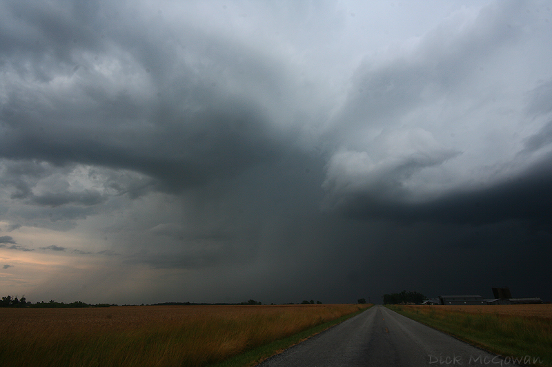
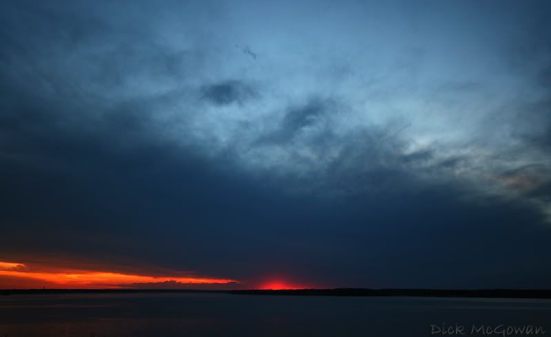
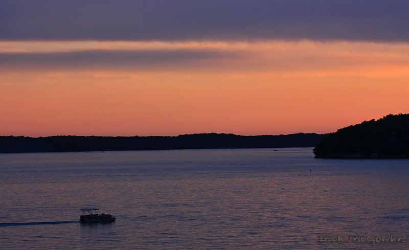
We drop further south to a blessed paved E/W county road, find a great spot and watch it. I took this while driving with the 17-70...


Then about 2 miles east on the 10-20, white balance/color is different between the two, either from the different lighting later on, or the XT vs. XSI AWB at that point in time.


Some guy pulls up and parks right in the road in front of the video we're streaming and starts talking up a storm, I tried to tell him to get his car out of the road, but I guess he didn't care. It was bugging me that he wouldn't and the fact he kept talking to Derek while I'm trying to enjoy the structure of the storm. I don't drive a car or SUV decorated with stickers, mesonets, or antennas for a reason... so people won't bother us while chasing. But they obviously see us outside of the vehicle with cameras and feel the need to start yapping and explaining to us what is happening with the storm lol. I try to be nice and courteous, and you just can't say, "Hey can you shut up and get the fuck out of here?", so I'll just tell the others I'm with, we need to move.

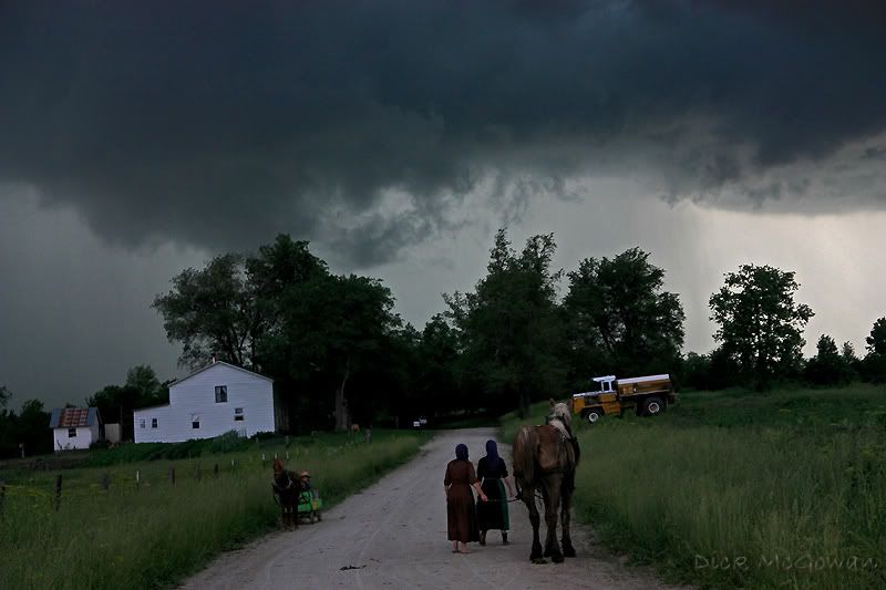
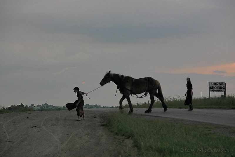
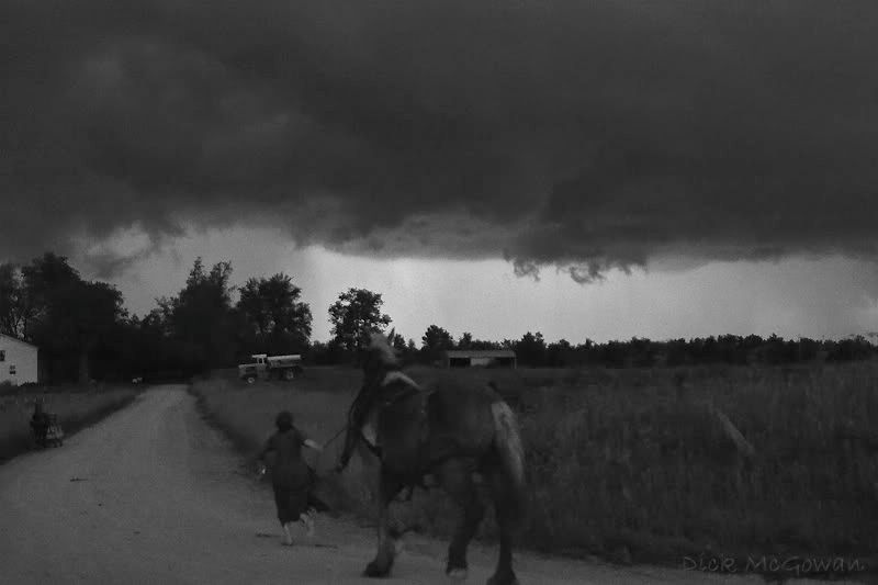
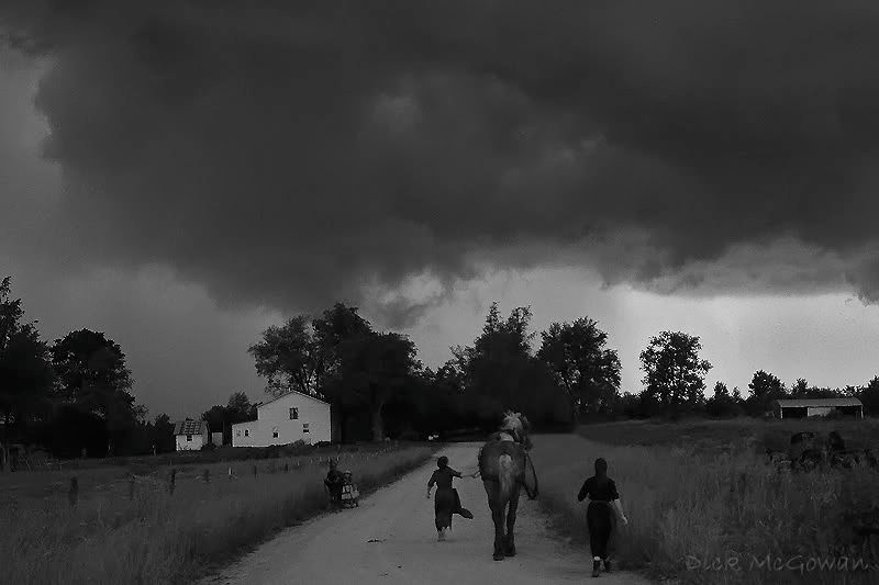
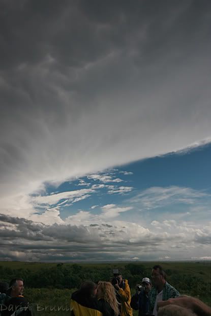
This guy asks if he can follow us, so Derek tells him, "Sure." Damnit! I tried to lose him on a hill (no offense if you're reading this BTW) but it doesn't work, and we finally find a good hill with a view of the storm we can't completely see all of, especially the area of interest. I don't chase to be social, in fact, on a slow-moving storm such as this, I like to just relax and watch it. We pull up and I see a guy standing in the field, and look behind us realizing we are next to an Amish family's farm!


From a thread I started on Stormtrack:

Derek Shaffer and I were chasing last week not too far northeast of Kansas City, and spoke to an Amish family while viewing the storm. I tried to snap a few pictures of them viewing the storm when they weren't looking, and for a few minutes, it really felt like a trip back into time. I wonder what they thought back then, what each storm would do? Very few, if any, would have been able to view enough storms in their lives to understand the behavior of storms/supercells, nor distinguish cyclic, tornado-producing machines from a powerful, multi-teared shelf cloud. Just thought I'd share a few pictures of the very old-fashioned Amish children viewing the storm.


Some pics, I cloned the truck out in the last photo ;) :


I sometimes think about this while driving, especially when I'm somewhere in Western Kansas, or those summer storms we sometimes chase within 150 miles in July. When it's crowded out there in May, cars whizzing by, it never really does. But when there is no civilization for miles, as an isolated supercell that is striated upwards like a barber pole spinning through the Gypsum Hills in Barber County, KS...or when that ominous shelf cloud striated like a wedding cake makes its way over the crest of the Flint Hills you can't help but think about what they thought or what fears they had.

We showed them radar which they had never seen before, and watched the children's eyes light up with curiosity, but never said a word. We had to leave as the storm was approaching and wanted to stay out of the core and told them goodbye.

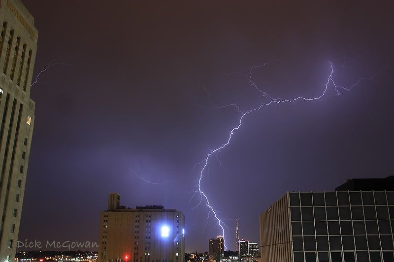
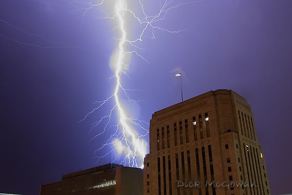
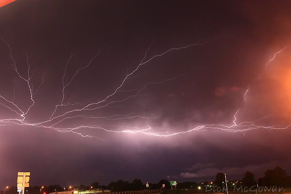
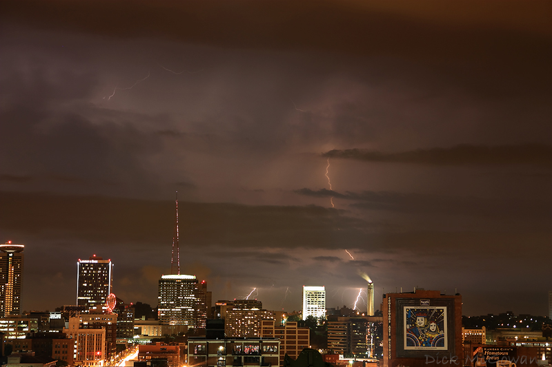
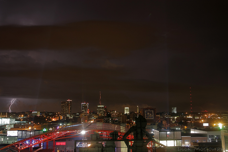
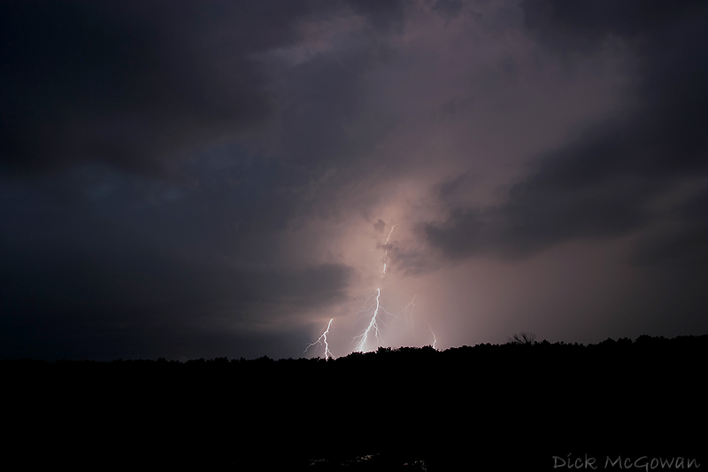
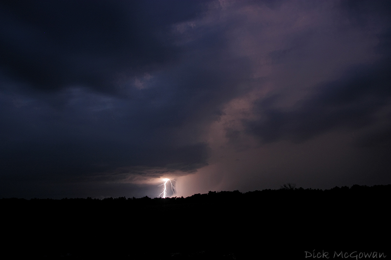
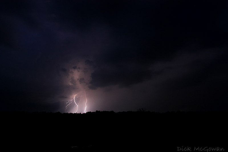
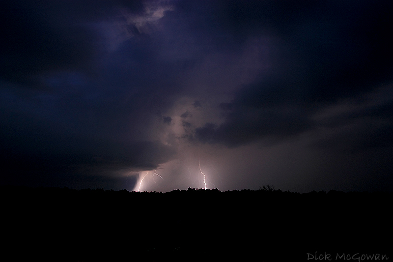
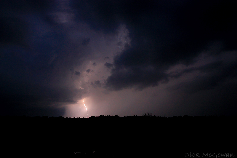
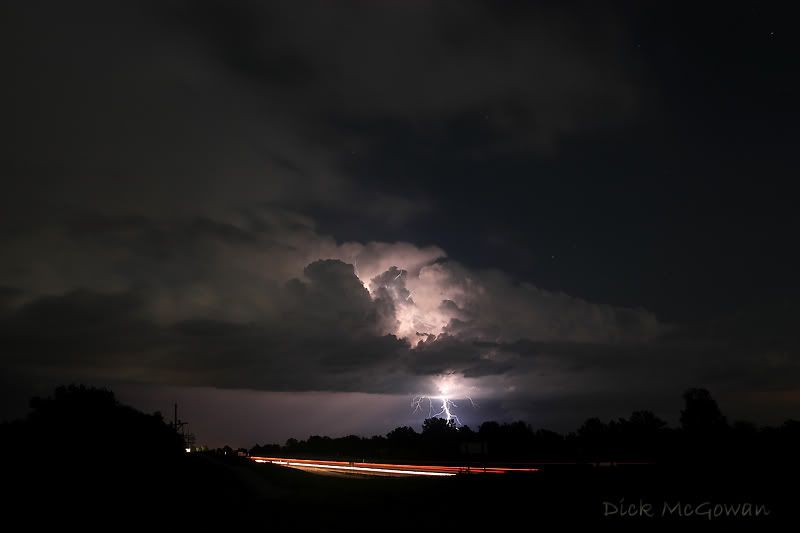
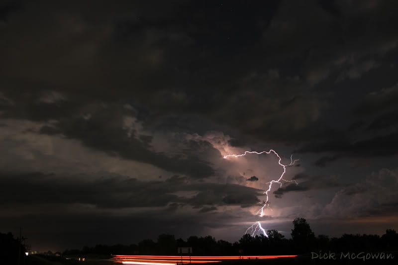
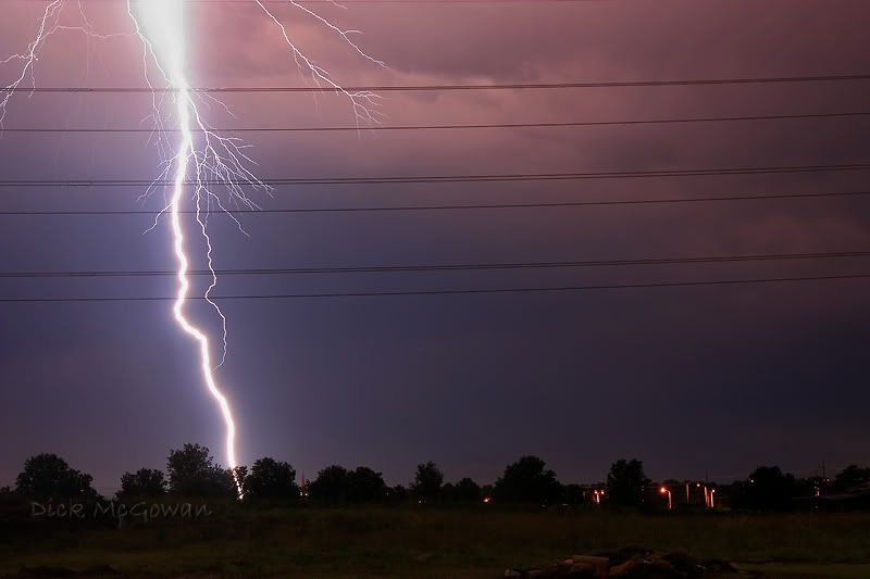
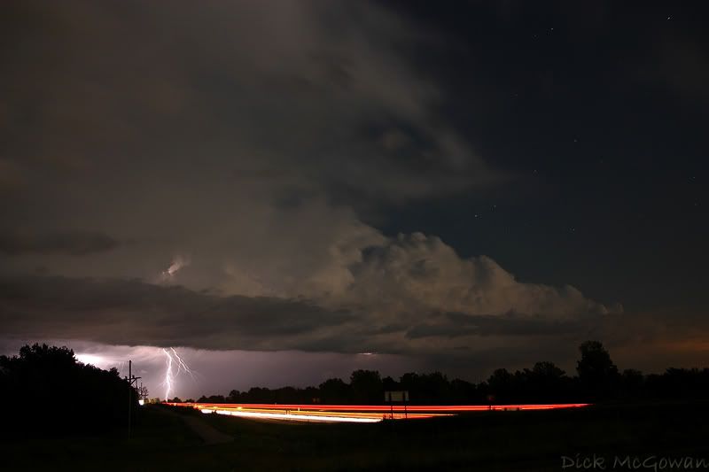
The day was pretty much over at that point as the sun was going down, but we decided to shoot lightning till 2 a.m., mostly on top of a parking garage in downtown K.C. 12 stories up, as storms trained just to the south, but enough mist/rain to get on our lenses and ruin the shot I wanted! We left there and noticed a huge fire to our north, which ended up being from lightning that sparked a huge gas tank which contained 1.2 million dollars. We videotaped it across the river for a few minutes, never saw anyone around and didn't think much of it till the next day when it made national news lol.

Every chase, it seems I always see something different or interesting; whether it's a cap bust or wedgefest, there's always a memory awaiting me when I head out, which makes this hobby that much more enjoyable.


Contact Me

Contact me @
midwesternmeso AT hotmail (DOT) COM

wibiya widget