In June of 1966, he owned a pharmacy on Gage Boulevard in Topeka, Kansas, and noticed the weather was getting bad and decided it was time to take shelter when he and my uncle saw a pop machine moving down the street, end over end! He ended up lying on top of my uncle inside the pharmacy and they both swear at one point, they were starting to lift up and felt as if they were floating before it was over. His pharmacy was completely destroyed by an F-5 tornado that hit Topeka, KS on that day.
Back to Hurricane Dolly...my uncle's bar and grill's roof in Arroyo City, Texas (which he was about to sell) was blown off, and his house badly damaged along the Arroyo there in Arroyo City and he was still without power. I haven't talked to him, but my mom has (which is her twin brother), but said he was in the eye with clear skies at one point! I'll post more about the damage and hopefully get some pictures of the damage soon...
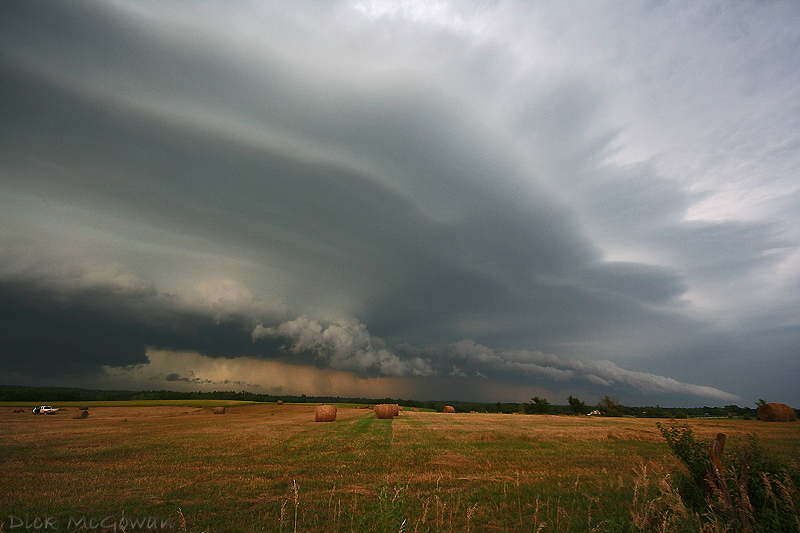
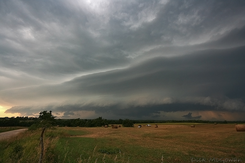
Derek Shaffer and I went out the other day to chase a busted tornado watch. The first pair of storms that went up near Troy, KS would have been the "players of the day" had they rode that outflow boundary southeastward, but rather moved E/NE into more stable air and would vaporize. The anvils on them looked rock solid when we reached them, but had to head further west to the only storm that fired in Nebraska, as we caught it near Seneca, KS...then south to Holton.
East of Holton, it had strong RFD that kept cutting in giving that strong swirling vertical motion on the edge of the gust front and the motion on it was very intense, but the storm remained outflow dominant and lost intensity shortly near dusk. The storm wasn't even severe warned at the, but winds easily exceeded severe criteria, throwing several large tree limbs our way east of Holton, KS.
Some pictures of the shelf cloud:
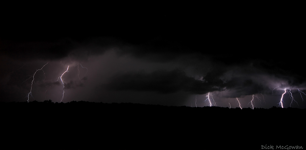
And a lightning image I got last night...9 CG's in just 30 seconds!
No comments:
Post a Comment