Email me at midwesternmeso (AT) hotmail [DOT] com Please note: All images and videos on this blog are copyrighted by myself and may not be used without written permission.Any persons or entities who do not seek written permission will be held liable for copyright infringement(s) and will be subject to monetary compensation not to exceed $150,000 USD. (In pursuant to 17 USC Section 504(b) and (c), 17 USC Section 505.)
Saturday, July 11, 2009
June 20th Account, More June 17th Photos/Video, June 15th Photos
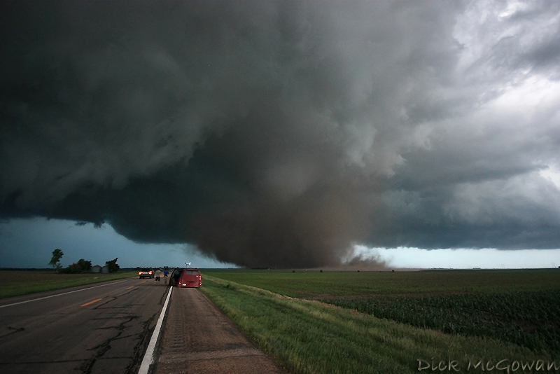
On June 20th, a warm front extended over parts of Central Kansas during the day with a lot of cloud cover and convection still ongoing from the warm air advection regime the night before, so I held little hope in chasing this day due to extensive cloud cover limiting instability, but the shear looked great for C/E. Kansas. With yet another cap bust in Iowa 2 days prior, and still high off of the June 17th Grand Island/Aurora supercell and tornado, I blew the day off for the most part. Darin, on the other hand, didn't and intercepted a storm that trekked from Wichita to where he intercepted it near Emporia. He called me telling me the structure was amazing, then called back again to say he saw a brief tornado...which I relayed to the NWS in Topeka. I then flew out the door and intercepted it near Princeton. I could see a funnel cloud off to my SW, so I again called the NWS in Topeka and gave them the play-by-play as it unfolded. At one point, the funnel extended 7/8ths of the way down and I was sure there was ground circulation somewhere and it warranted a brief touchdown report. As I was on the phone, I told the gentleman to hold on, so I could get some proof and by that time, it had began to rope out and formed a new area of rotation just to the east. That's where this video starts.
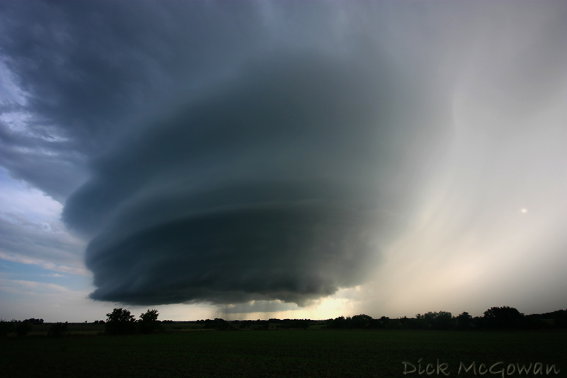
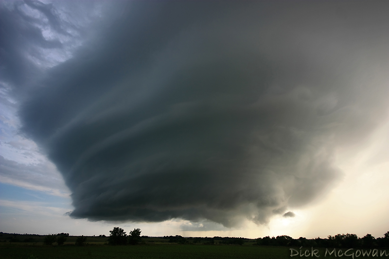
A couple of pictures of it shortly after the video:
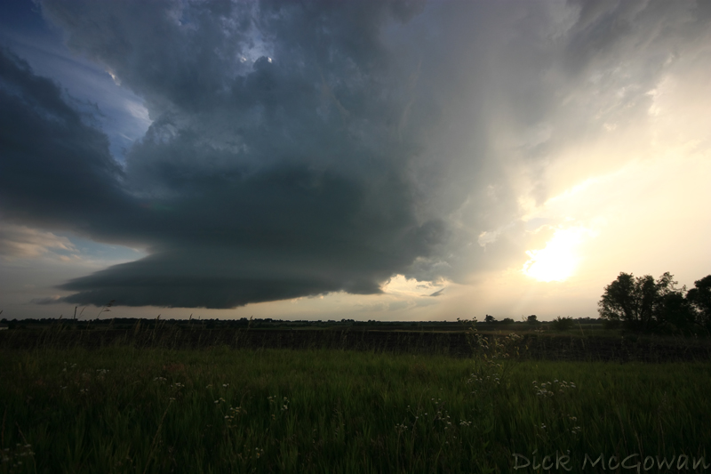
And then as it weakens towards sunset:
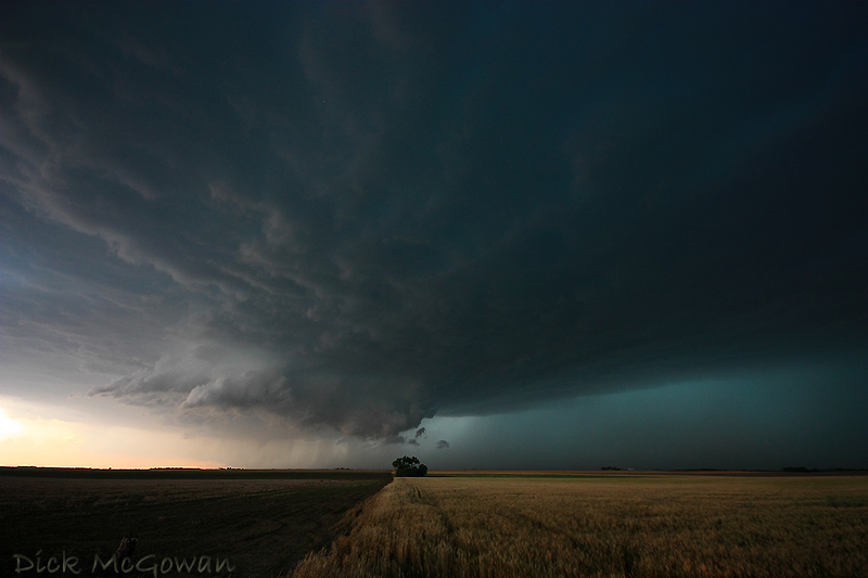
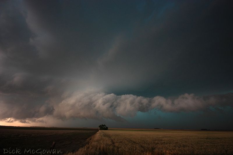
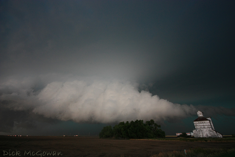
A few pics of a wall cloud that I was 99 percent sure was heading towards being outflow dominant on June 15th (video is in my previous blog entry below). Taken west of Kinsley, Kansas.
And finally, more June 17th Aurora Video and another photo, below. Next year, I plan on owning the Canon 5D Mark II with an assortment of "L" quality lenses so I can get around the noise factor and shoot higher quality photos. Darin is planning on purchasing the Sony FX1000 for better low light and higher quality video. More blog entries coming and additional photos I've yet to process sometime this summer.
This is a timelapse (and damage footage) of the Aurora Tornado shortly after the first video I posted in my previous blog entry.
1 comment:
Great pix! I always look forward to seeing what you post.
Post a Comment