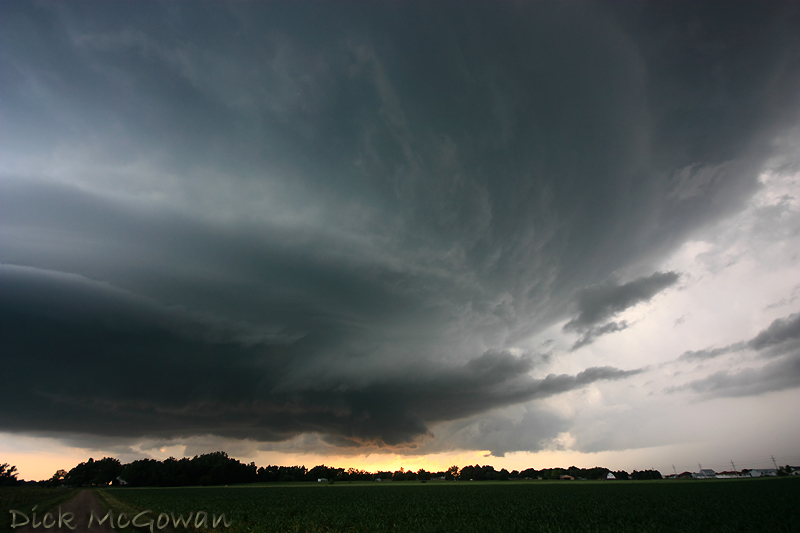
The supercell (below) as the new updraft formed and strengthened dramatically right before our eyes just a few miles west of Grand Island. We hung back a little ways at this point to get some structure shots as it wasn't close to producing a tornado.
Quick Note: These photos/videos are copyrighted by myself and any unauthorized use will be prosecuted to the fullest extent of the law, regardless of the party or parties involved.
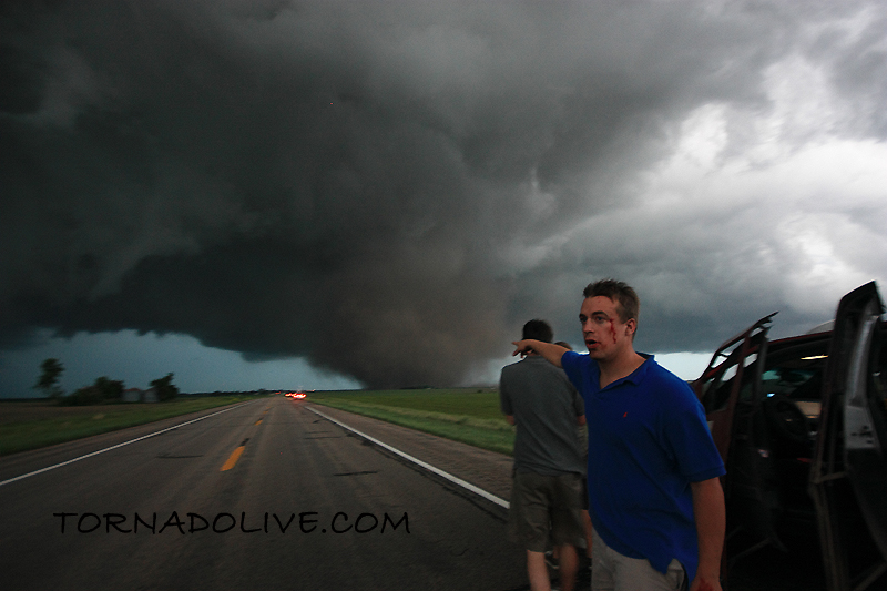
Reed Timmer (below) as he looks on, still in shock, from taking a direct hit from the tornado (and can be seen in the video driving by, then tail lights as it forms in front of us). His outer window was broken out (bullet-proof window could not be pulled up in time), spraying glass into his face and others riding in the Dominator (aka SRV - Storm Research Vehicle).
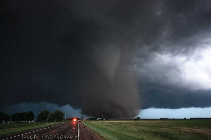
Another of the tornado later on:
More later, I've been extremely busy lately. I also intercepted on Saturday two brief tornadoes near Princeton, Kansas and was on the phone with the TOP NWS most of the time, but did manage to snap a lot of photos and video.
1 comment:
Sick photos dude! You and some others have some of the best supercell/tornado photos I have ever seen courtesy of this storm.
Post a Comment