Email me at midwesternmeso (AT) hotmail [DOT] com Please note: All images and videos on this blog are copyrighted by myself and may not be used without written permission.Any persons or entities who do not seek written permission will be held liable for copyright infringement(s) and will be subject to monetary compensation not to exceed $150,000 USD. (In pursuant to 17 USC Section 504(b) and (c), 17 USC Section 505.)
I was extremely bored the other night, and remembered where I saw hundreds of fireflies the night before, so I tried to shoot them. I did a test shot in 800 ISO but forgot to put it back down to 100, I GUESS. So it's a little grainy. I'm done chasing for awhile, as it seems like the Central Plains season is over. After my summer class, I'm officially a college graduate. Yay.
Well, what a month for Olathe, KS. So a girl goes missing in Olathe, and some guy I'd like to kick the crap out of, murders her and gets national exposure. Turns out this guy is linked to another missing girl.
So I show up to work on Friday, and look out my window, and evidently a bank robbery has unfolded 100 feet from me. I have come to believe that I watched these guys case the thing from our alley the day before. How do I know this? Wyandotte county tags don't fly in Johnson county, and these guys were looking around like they were doing something other than being in an alley near the bank. This is the second time I've been near a bank robbery, for the bank that I go to.
I watch the news later that day, and guess what? Yep, largest drug bust in Johnson County, KS. 500 pounds confiscated from a semi, near the weigh station. Oh, and guess what else happened last month? An Asian massage parlor is busted for giving oral sex 3 doors down. I heard rumors at work about it, but always dismissed it. Maybe I need to find a different place of employment.
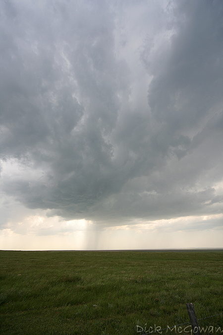
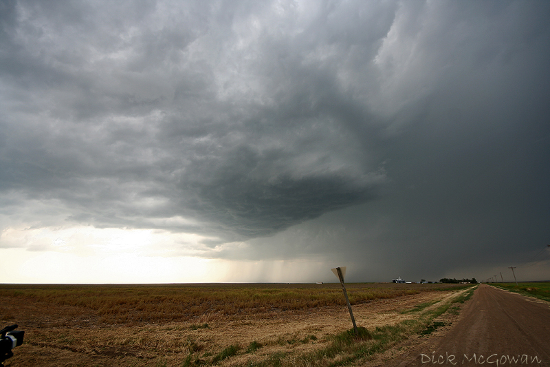
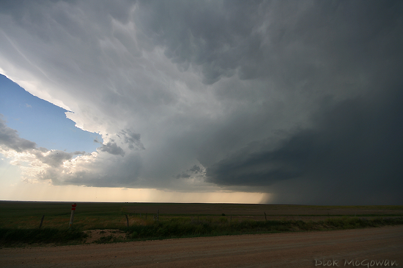
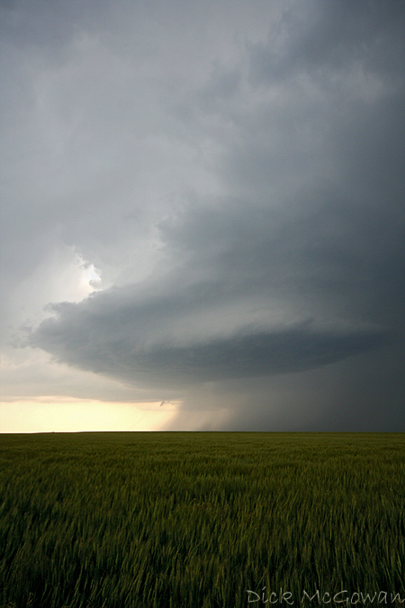
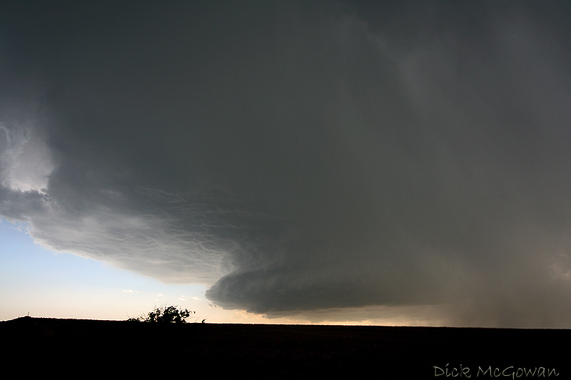
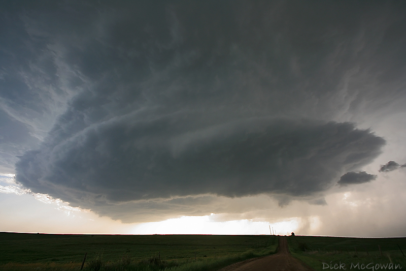
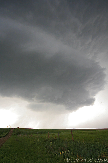
Anyways, Here are some pics of recent storms I've photographed. Nothing Spectacular, but it beats clear skies.
I've edited this post on 12/8/2008 due to the recent high number of hits from an unknown email source...with copyrighted/watermarked images.
Darin Brunin, Jordan Wrecke, Todd Beal and I witnessed the best structure I have ever seen! We trailed a Cu field near Amy, KS to Healy, KS where it began to tower. For the next several hours (more like 5), we watched it mature into a supercell, then die out to the one further south, which would produce the brief, perfectly-contrasted tornado!
No returns on radar and it already had an anvil!
We're alone on this storm at this point.........but not for long. Thing is really high-based, but I don't care. Structure is just as good as a tornado.
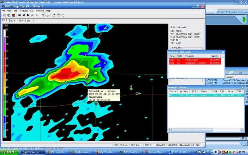
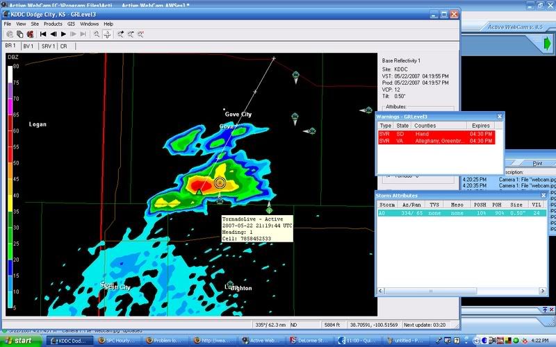
Darin took these screen caps showing our position.........then the bees swarmed the lone cell!
It's now moving N/NE and the meso on it now is just breathtaking. Notice the new supercell forming to it's s/sw. It would eventually die off.
A few minutes later....
After watching it pull in scud as it crossed I-70 (and someone calling in the funnel that wasn't attached to the base!), we sat NE of Colyier (sp?) and filmed it some more, as a wall cloud was now forming. Andrew Pritchard and Mark Sefried pull up, and we chat for a bit, before they leave and head north. Mike Hollingshead pulls up about 1/4 mile back south down the road. We had just talked about how this was a "Hollingshead" type of storm. We leave, and go north, with known chasers pulling out in front of me (jackasses) not once, not twice, but on THREE different occasions. What are the odds? Not only that, but their convoy didn't chance it, and rode my ass while they did 10 mph on a dirt road hanging their heads out of the sunroof!
So I pass them, when they hit the brakes for the 10th time, and now a funnel cloud is starting to come down. It came very close, but I don't think that it ever touched. We followed it up the road a few miles, before the new supercell to the south's FF killed our meso, so we went back south, getting hailed on pretty good as we did. A beautiful mothership is now in view, and very, very close to us. I am looking straight up, and can see this monster rotating. The vault is just to our w/nw, so we snap a few pics and head back east.
This is why I wake up every day:
I couldn't even fit it all in at 10 mm! We should have moved back east, but there was nowhere to park really (We were on dirt roads 90 percent of the day). Darin got a call from the NWS at this point, and we told them no signs of a tornado yet, but it was definitely rotating!
So we move back east, then north, and we can't beat the precip so we head back south, then east. It's now filling in pretty well, and we lose the area of interest for a bit, then get a glimpse of it before it gets wrapped again. So we decide to get way east, as that would be the only view. We can see a rapidly rotating wall cloud, so I pull over and it tries to do it......
But it doesn't. So we jump in and head east again (man these roads were perfect with no mud, and good traction.) as it starts to funnel more. I'm being extremely cautious with driving, as I know the chaser police lurks out there. We reported it on Spotter network as a funnel 3/4 down. It then touched for a couple of minutes, about 2-3 miles to our north, before roping out.
Here's a quick video clip (That's Darin talking in the beginning, giving me a quick lesson in driving. I say "Oh no!" at the end, because a firefighter was blocking the road!)
We finally hit a highway, which was jam-packed full of chasers. We see a new meso, and it's pulling in scud pretty hard. Everyone in front of me is now pulling over to the side, because it starts to rotate pretty hard now. We get about 1/8 mile to the west of it, as a little funnel comes and goes. We've lost it now, because we couldn't park anywhere, and kept heading north. Punched through the core as we are now east out of Hill City. A plethora of idiots are now passing me (I'm doing 70 in a 65), while core-punching in zero visibility. We get to a new tornado warned storm, but it looks OFD and cold, so we ditch it and head back towards Hays to get gas. It's now night time and a cell to our west went tornado warned. We take pics and video it for a good 30 minutes, watching the incredible lightning show. Then head east and film it some more. It's now a gigantic shelf, with some GREAT structure. We're pretty tired, so we headed back to Lawrence. Almost the perfect chase day!
Darin, Jordan, Todd Beal and I intercepted a nicely sculptured storm near Meade. Met Mike Umscheid also. Preparing for today, but it doesn't look as good as it did. We'll find the triple point in the morning and hope there will be a short window for tornadoes. I'm not feeling too good about it. Currently in Dodge City, this town has absolutely no hotel rooms.
Here is a google map with the best that I can remember of where we saw tornadoes and damage. I left my laptop on and the battery died with the GPS info.
Large tornado near Macksville/ St. John, KS on 5/5/07 approximately 1/4 mile away. RFD is hitting us hard here, I've never seen such strong RFD besides Greensburg the night before. When it would pulsate, little swirls in the grass/ground were visible.
This one was when we turned around after the RFD obstructed our view and was approximately 150-200 yards away. We got up pretty close to it......it looks little, but the motion on it looked pretty strong.
The rope would essentially rope out, but the meso kept rotating HARD and would put this cone down with multiple vortices dancing around it. It came very close to hitting a farm, thank God it didn't. It would dance around on a merry-go-round forever.
It became rain-wrapped and we would have to go back south then east, then back north to reposition. (Evidently it never stopped, because there was a wedge on the ground when we got north of St. John's, actually 2 old meso and a new one) The next 20 minutes were very chaotic as I missed my turn east to dodge the closest wedge. We were sort of trailing it to our west about 1/4 - 1/2 mile, when visibility went to absolute shit, and I lost it. Inflow started to really suck in from the east, and I had no idea of where the tornado was, none of us did. We made a very quick decision to punch into the core, from the hook north, and risked losing a windshield. We made it to Great Bend on no gas....and the convenience store clerks refused to turn the pumps on for me, so I argued with them and finally grabbed a friends check card with 1 inch hail hitting me hard while I pumped. We floored it out of Great Bend, to Hoisington, and decided we had seen enough strong-violent tornadoes up close for the weekend.
This one is a video capture of the "Greensburg" supercell near Sitka, KS on 5/4/07. Wish I could have fit the whole storm into one picture.........it was truly amazing, the inflow tail that fed into it stretched for miles and miles.
Darin has a picture of the very first brief cone tornado on his blog which you can click on my links over on the right. Andy Fischer has a pic of the second tornado, a classic Kansas tornado, really, really thin truncated rope.(Is there such a thing lol?)
Here is the third tornado which started out as a large cone, and grew into an O'Neill Nebraska type stovepipe. I was drooling. O'Neill is probably my favorite tornado of all time, by looks, and this was it! Only light was fading away, and Derek stopped filming it before it grew into a monster. We were more concerned with the developing tornado right in front of us. So, no pics of the stovepipe, just of the large truncated cone:
Here is the left-split (or so I am told) of the original 3 amigos that formed near the OK/KS border. As you can see, I had the Sigma 10-20 and wasn't close enough to shoot what I was seeing, but it was beautiful! My first stacked plates ever! I'm a structure freak, what can I say. I know Darin has better photos, if he'll ever put them up.
The rest are the best screen caps I could get of the Greensburg tornado family. "the stovepipe" before the wedge.
Not sure what it's doing here......it may have gotten smaller? at one point, it didn't look as wide....probably multiple vortices also near it there (camera is oof).
The transition to the above pic and this was about 2-3 minutes....
I am done doing interviews, telling my story, talking about this. The guilt is getting to me today. For Christ's sake, there were people in those houses. I should have looked in more houses. I wish I would have busted. This is horrible, I can't live with myself. Any media, or anyone that wishes to know any more can ask Derek Shaffer or Darin Brunin. It stops.