Email me at midwesternmeso (AT) hotmail [DOT] com

Please note: All images and videos on this blog are copyrighted by myself and may not be used without written permission. Any persons or entities who do not seek written permission will be held liable for copyright infringement(s) and will be subject to monetary compensation not to exceed $150,000 USD. (In pursuant to 17 USC Section 504(b) and (c), 17 USC Section 505.)
Showing posts with label Best Storm Photos. Show all posts

Wednesday, September 23, 2009

Top Storm Photos of 2009

Even though there might be a small chance for severe weather in the next week or two, I thought I'd post my favorite storm photos of 2009. I was lucky enough to capture some decent shots in 2009, especially tornadoes. And despite the crappy year that a lot of chasers have had, we've had probably our best year yet...intercepting tornadoes in every month from March until July. Here is a link to last year's top photos.

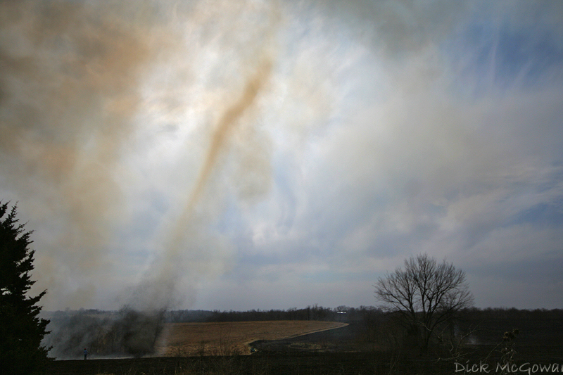
A 'firenado' back on March 6th, almost as good as the real thing up close:

Firenado

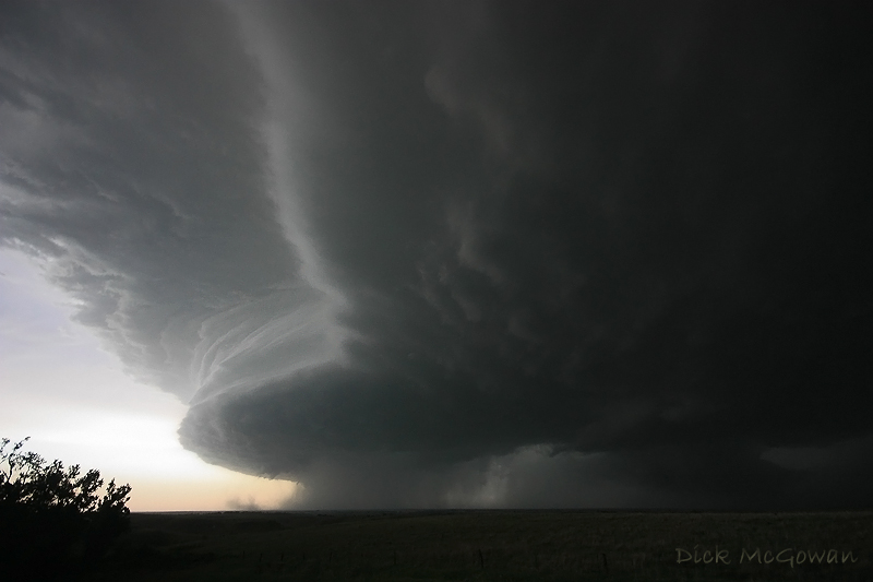
April 26th, near Roll/Crawford, OK:

Roll Oklahoma Tornado

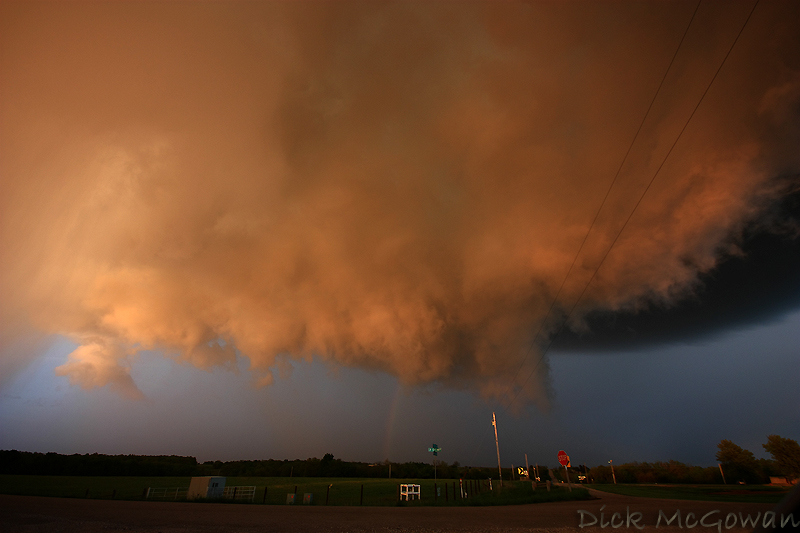
May 6th, 2009 in Linn County, KS a brilliant sunlit wall cloud and rainbow beneath a low-topped supercell...one that didn't even make it into the reports, but is forever etched into my mind:

Linn County Low-Topped Supercell + Wall Cloud

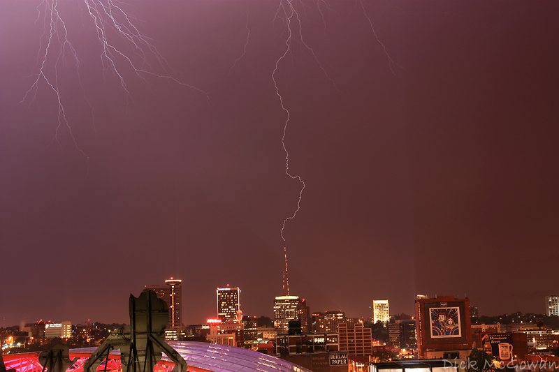
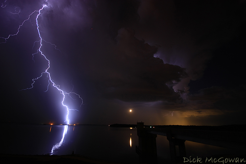
May 30th, Clinton Lake Dam, KS, Lightning shot with the moon setting underneath the updraft :

Clinton Dam Lightning + Moon

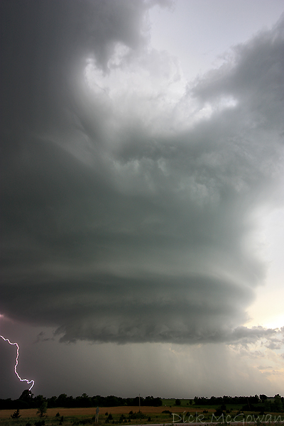
June 15th, 2009 near Kinsley, KS:

06152009_02web

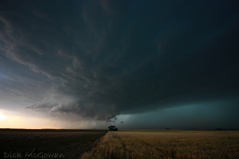
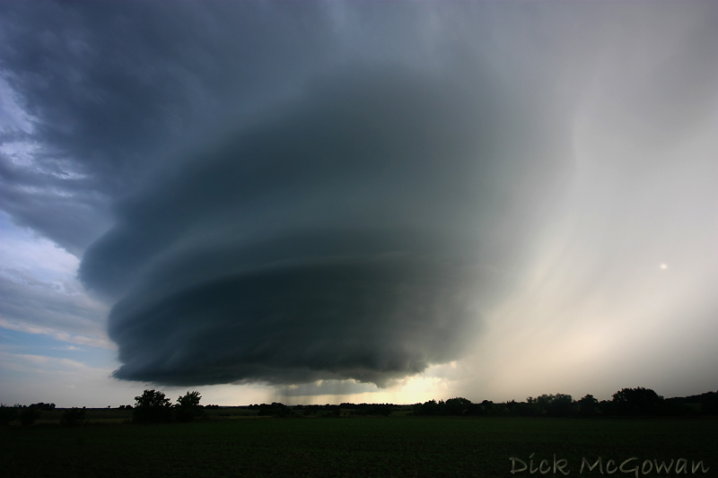
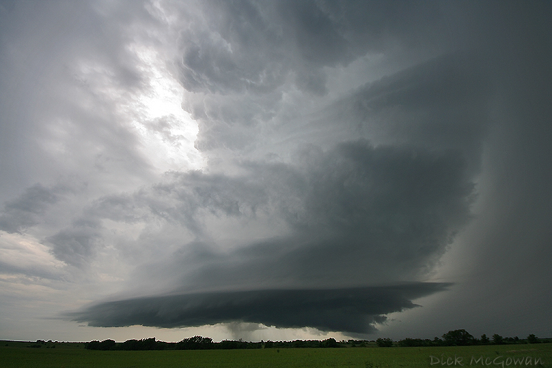
June 17th, amazing structure just west of Grand Island, Nebraska (wish I were just about 2 miles further east) :

Grand Island, Nebraska Supercell

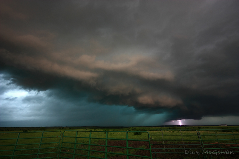
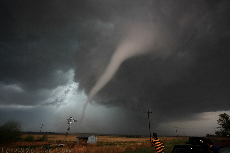
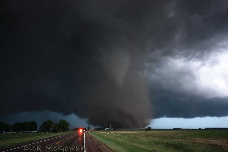
June 17th, the Aurora, Nebraska tornado as it begins to cross back north of the highway...a few miles west of Aurora:

Aurora, Nebraska Tornado

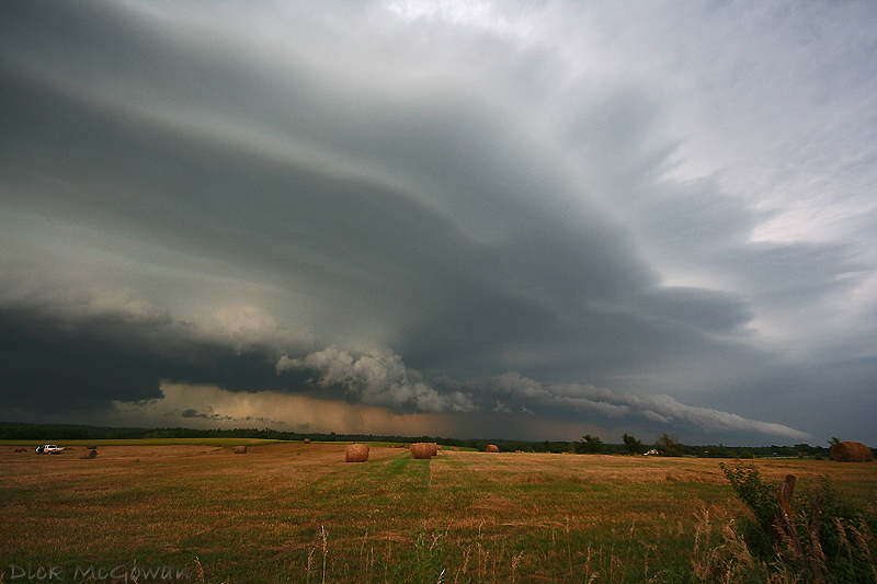
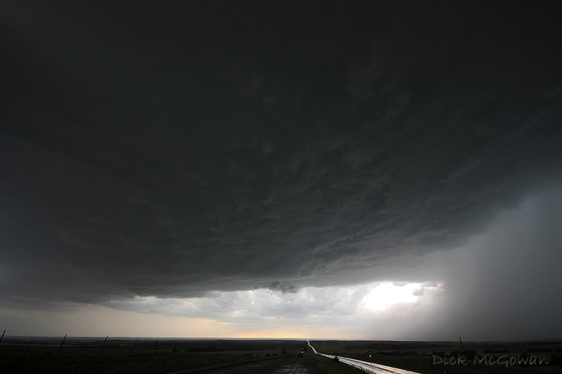
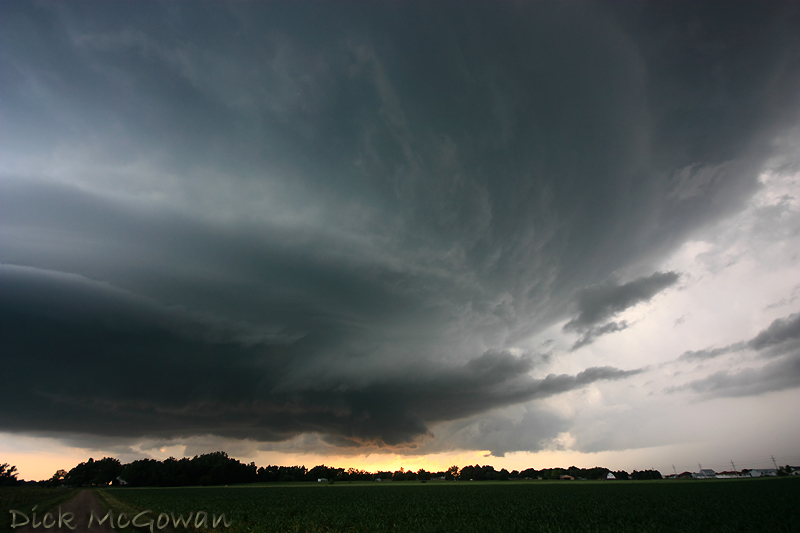
June 20th, Princeton Kansas 'mothership' supercell which produced several, weak, brief tornadoes, but the structure stole the show:

Princeton, KS supercell

Wednesday, October 15, 2008

Top 10 Storm Photos of 2008

Well, seeing little hope besides *maybe* late next week for an opportunity to chase, it's time to post my best storm photos of 2008 in no particular order.

June 5th, high risk day...taken in Pottawatomie County, Kansas:

pottawotomie05web

July 2nd, surprise in Lyon/Osage County, Kansas:

july201web

July 24th, red box bust, just north of Holton, Kansas:

Holton, Kansas Shelf Cloud

June 11th, moderate risk, Kanapolis State Park, Kansas:

brookville02web

July 29th, surprise tornado-warned, low-topped supercell near Olpe, Kansas:

olpe02web


May 25th, NW Barton County, Kansas:

5260801web

June 11th, Near Concordia, Kansas:

concordia02web

April 23rd, Ottawa, Kansas:

web_ottawa04

July 2nd, Downtown Kansas City lightning:

july206web

June 3rd, NW Missouri, Amish children's reaction to an approaching storm:

bfe09web

Contact Me

Contact me @
midwesternmeso AT hotmail (DOT) COM

wibiya widget