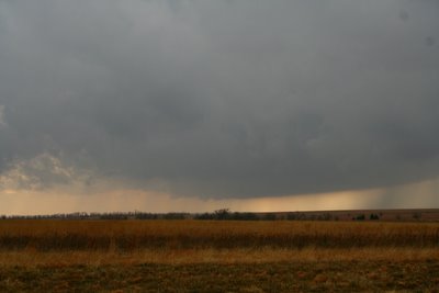


I'll sum it up short. We analyzed SPC's mesoanalysis page at around 11 a.m. A decision was made for Topeka, KS. About an hour later we received a call from Nick Grillo giving his thoughts and sharing with us his observations. Thanks for that Nick. Darin then called Roger Schwartz of WIBW in Topeka, KS, and thought Emporia might be a better idea. So off we went. Soon after we received a call from Eric B' Hymer that an Mesoscale Discussion was up and a tornado watch would be issued soon. Minutes later it was for much of Eastern KS. At about the time we were about 20 miles from Emporia on the turnpike, Darin called Stewart Manning for an update. There was an impressive cell near the Butler Sedgwick County line, and we calculated the time to intercept and felt this was the cell we wanted to be on. We went west on highway 50 then turned onto 150 highway where a base was visible. We drove a little further north to stay on southern edge of this new mesocyclone. Here are some pictures from beginning to end starting bottom to the top: First Picture base, and at this point we turn around seeing a new storm starting to seed ours. So we drive back south but just for about 2 minutes. I look back and say "Oh man it's getting it's act together." A small funnel emerges, we reposition back, and I began to shoot these first photos. Timeframe from meso to funnel cloud, I would say 3 minutes tops, and notice how fast the RFD cuts in and the meso wraps around.
I will post the other tornadoes later, gotta run for now.
1 comment:
Great job Dick. Awesome pics and video.
Post a Comment