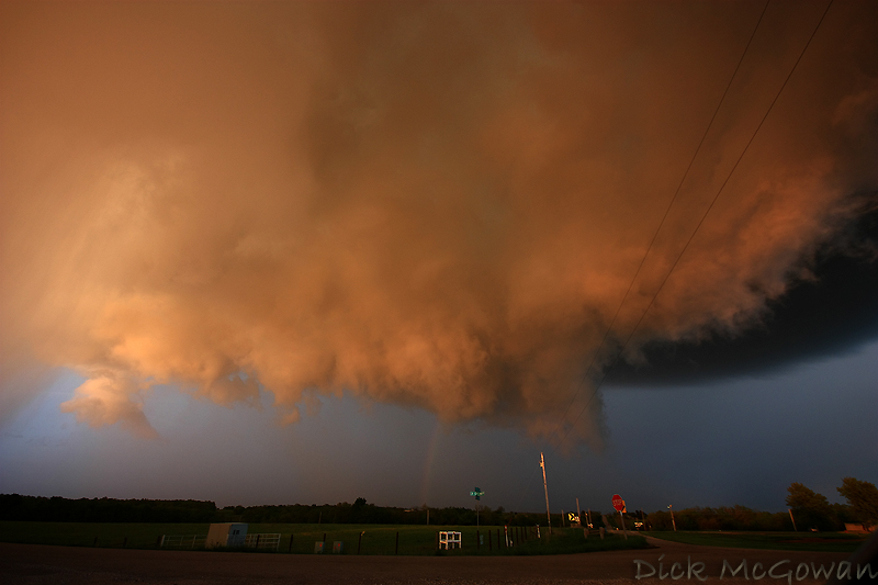
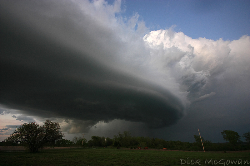
About 3 p.m., I noticed a lot (100-150 j/kg) of 0-3km CAPE pooling along a surface trough in Eastern Kansas while an upper level disturbance moved SE from NE/IA. There were relatively cool temps aloft (-14 - 18 at 500 mb) and upper 50 to low 60 dewpoints in place. I emailed Darin at work and he had noticed this too, so we met up around 4:30 in Eudora and watched numerous towers go up and down along this boundary to our immediate west. After most dissipated, more went up to our south, so we moved to near Ottawa, KS and watched much of the same. Luckily, persistence paid off and two storms eventually became one supercell which nearly produced a tornado in Linn county, KS. It didn't matter though because the structure was amazing and the orange hue the wall cloud and rain curtains we saw made everything seem like a dream. Below are just a couple of photos I've processed, I'll add more (as I'm headed to work now) later. Not too confident in today's setup around here today, but we'll chase it regardless.
5 comments:
Don't you just love surprises like that in your backyard! :)
I guess those are pretty. Psh. ;)
Awesome Photos!!!!
You are an amazing photographer. But then again, your subject is pretty amazing, too.
Wow, what a thrilling place to be...love a good storm!
Post a Comment